MyTopo
Indian Spring Montana US Topo Map
Couldn't load pickup availability
Also explore the Indian Spring Forest Service Topo of this same quad for updated USFS data
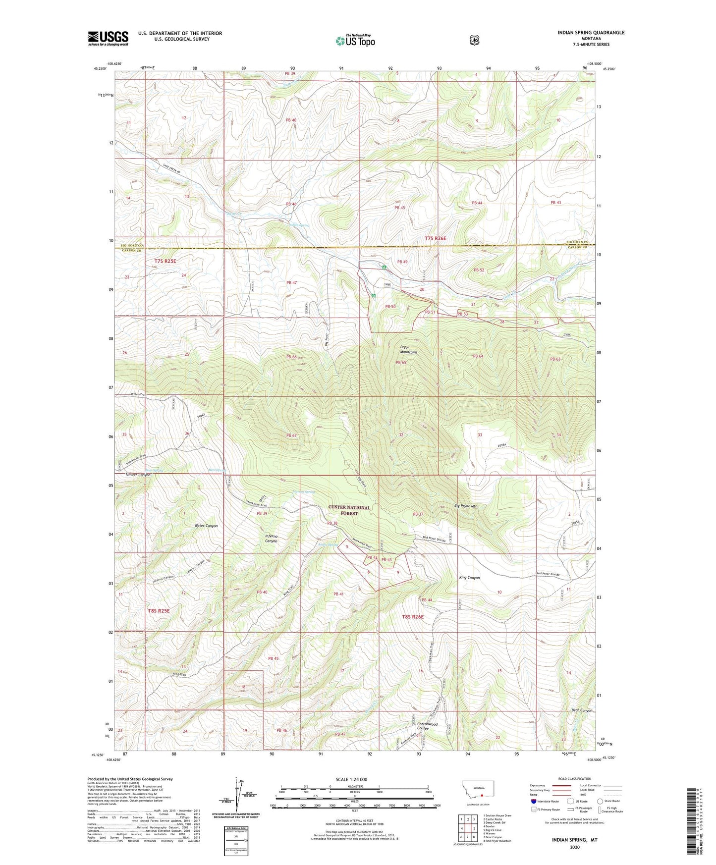
2024 topographic map quadrangle Indian Spring in the state of Montana. Scale: 1:24000. Based on the newly updated USGS 7.5' US Topo map series, this map is in the following counties: Carbon, Big Horn. The map contains contour data, water features, and other items you are used to seeing on USGS maps, but also has updated roads and other features. This is the next generation of topographic maps. Printed on high-quality waterproof paper with UV fade-resistant inks.
Quads adjacent to this one:
West: Bowler
Northwest: Section House Draw
North: Castle Rocks
Northeast: Deep Creek SW
East: Big Ice Cave
Southeast: Red Pryor Mountain
South: Bear Canyon
Southwest: Warren
This map covers the same area as the classic USGS quad with code o45108b5.
Contains the following named places: Angus Spring, Bainbridge Cabin, Bear Spring, Bent Spring, Bent Trail, Cummings Post Office, Graham Cabin, Indian Spring, Ingram Spring, King Trail, North Fork Sage Creek, Sage Creek Campground, Sage Creek Ranger Station, Shriver Post Office