MyTopo
Black Butte Montana US Topo Map
Couldn't load pickup availability
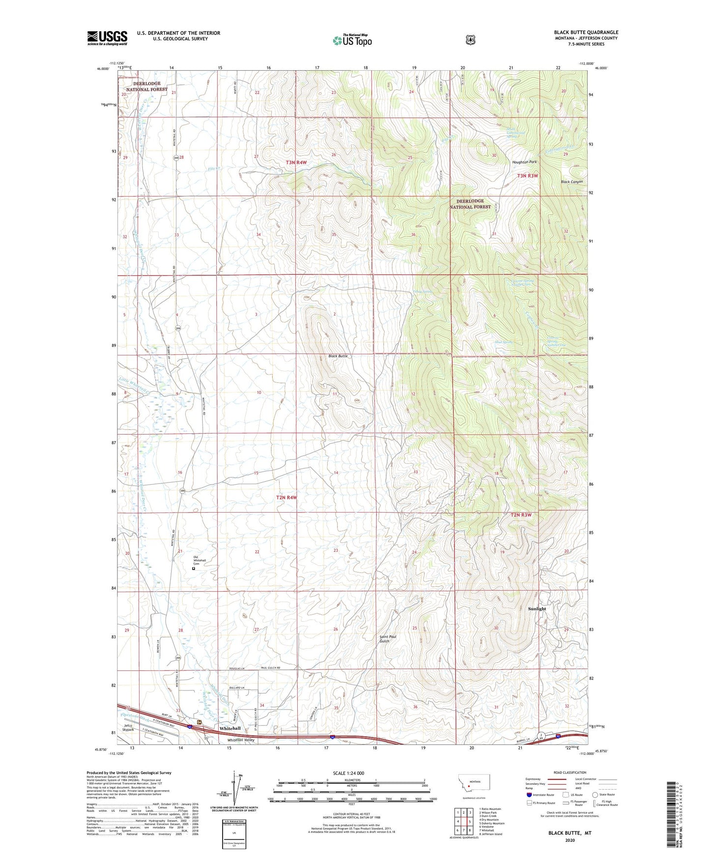
2020 topographic map quadrangle Black Butte in the state of Montana. Scale: 1:24000. Based on the newly updated USGS 7.5' US Topo map series, this map is in the following counties: Jefferson. The map contains contour data, water features, and other items you are used to seeing on USGS maps, but also has updated roads and other features. This is the next generation of topographic maps. Printed on high-quality waterproof paper with UV fade-resistant inks.
Quads adjacent to this one:
West: Dry Mountain
Northwest: Ratio Mountain
North: Wilson Park
Northeast: Dunn Creek
East: Doherty Mountain
Southeast: Jefferson Island
South: Whitehall
Southwest: Vendome
Contains the following named places: 02N04W04DCCC01 Well, Battle Creek, Black Butte, Brookes, Carbonate Mine, Conrow Spring Number One, Conrow Spring Number Two, Correa Ranch, Examiner Mine, Fitz Creek, Forcella Ranch, Gem Mine, Golden Mine, Houghton Park, Iron Side Mine, Jefco Skypark, Jefferson Ranger District Office, Little Whitetail Creek, Luck Heat Mine, Minerva Mine, Mud Spring, NW NE Section 13 Mine, Old Whitehall Cemetery, Parrott Mine, Perhaps Mine, Saint Paul Gulch, SE NE Section 24 Mine, SE NW Section 13 Mine, SE SE Section 13 Mine, SE SW Section 12 Mine, Sheep Rock, South Cottonwood Spring, Sunlight, Sunlight Mine, SW SW Section 18 Mine, Tebay Spring, United States Forest Service Law Enforcement Whitehall Office, White Tail Deer, Whitehall Division, Whitehall Ranch, Whitetail Ditch