MyTopo
Black Pyramid Mountain Montana US Topo Map
Couldn't load pickup availability
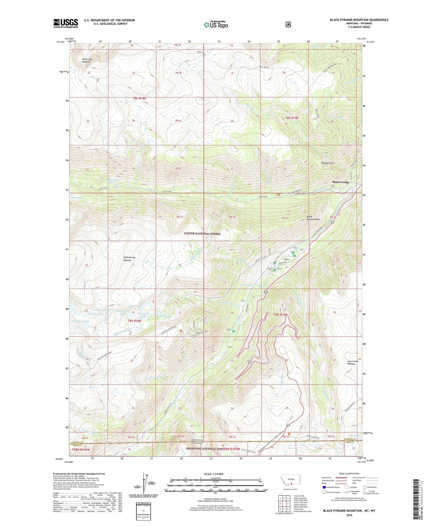
2020 topographic map quadrangle Black Pyramid Mountain in the states of Montana, Wyoming. Scale: 1:24000. Based on the newly updated USGS 7.5' US Topo map series, this map is in the following counties: Carbon, Park. The map contains contour data, water features, and other items you are used to seeing on USGS maps, but also has updated roads and other features. This is the next generation of topographic maps. Printed on high-quality waterproof paper with UV fade-resistant inks.
Quads adjacent to this one:
West: Silver Run Peak
Northwest: Sylvan Peak
North: Bare Mountain
Northeast: Red Lodge West
East: Mount Maurice
Southeast: North Bennett Creek
South: Deep Lake
Southwest: Beartooth Butte
Contains the following named places: Black Pyramid Mountain, Broadwater Lake, Buena Vista Campground, Chain Creek, Crescent Lake, Daly Lake, Edsel Mine, Elk Horn Lake, Gallon Jug Mine, Grass Creek, Greenough Lake, Greenough Lake Campground, Greenough Lake Recreation Site, Hellroaring Creek, Hellroaring Lake, Hellroaring Lakes, Hellroaring Plateau, Laduala Creek, Lake Fork, Limber Pine Campground, Limberpine Recreation Site, Line Lake, Lions Club Camp, Lost Picket Creek, Misery Creek, M-K Campground, M-K Recreation Site, Parkside Campground, Plateau Creek, Quad Creek, Richel Lodge, Rydberg Lake, Silver Falls Creek, Silver Run Plateau, Smethurst Lake, Snowbank Lake, Tolman Point, Wyoming Creek, ZIP Code: 59068