MyTopo
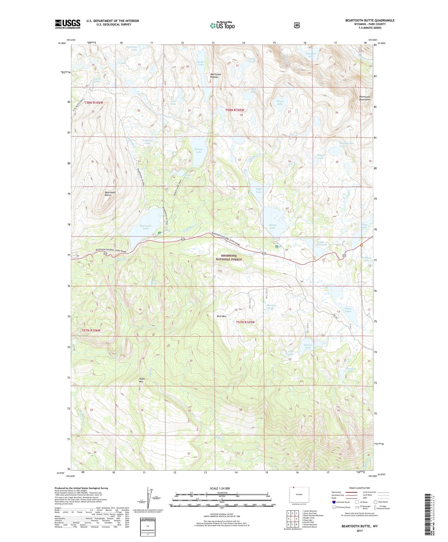
Beartooth Butte Wyoming US Topo Map
Couldn't load pickup availability
Also explore the Beartooth Butte Forest Service Topo of this same quad for updated USFS data
2021 topographic map quadrangle Beartooth Butte in the state of Wyoming. Scale: 1:24000. Based on the newly updated USGS 7.5' US Topo map series, this map is in the following counties: Park. The map contains contour data, water features, and other items you are used to seeing on USGS maps, but also has updated roads and other features. This is the next generation of topographic maps. Printed on high-quality waterproof paper with UV fade-resistant inks.
Quads adjacent to this one:
West: Muddy Creek
Northwest: Castle Mountain
North: Silver Run Peak
Northeast: Black Pyramid Mountain
East: Deep Lake
Southeast: Dillworth Bench
South: Windy Mountain
Southwest: Hunter Peak
This map covers the same area as the classic USGS quad with code o44109h5.
Contains the following named places: Beartooth Butte, Beartooth Falls, Beartooth Highlakes Trail, Beartooth Lake, Beartooth Lake Campground, Beartooth Plateau, Beauty Lake, Beauty Lake Trail, Becker Lake, Bird Mountain, Chain Lakes, Cliff Lake, Crane Lake, Echo Lake, Emerald Lake, Fantan Lake, Grayling Lake, Heart Lake, Island Lake, Island Lake Campground, Little Bear Creek, Little Bear Lake, Lonesome Lake, Long Lake, Long Lake Campground, Meadow Lake, Native Lake, Night Lake, Paradise Lake, Rainbow Lake, Sheepherder Lake, Sill Lake, Snow Lake, Snyder Lake, T Lake, Table Mountain, Wall Lake