
MyTopo
Blair Ranch Montana US Topo Map
Couldn't load pickup availability
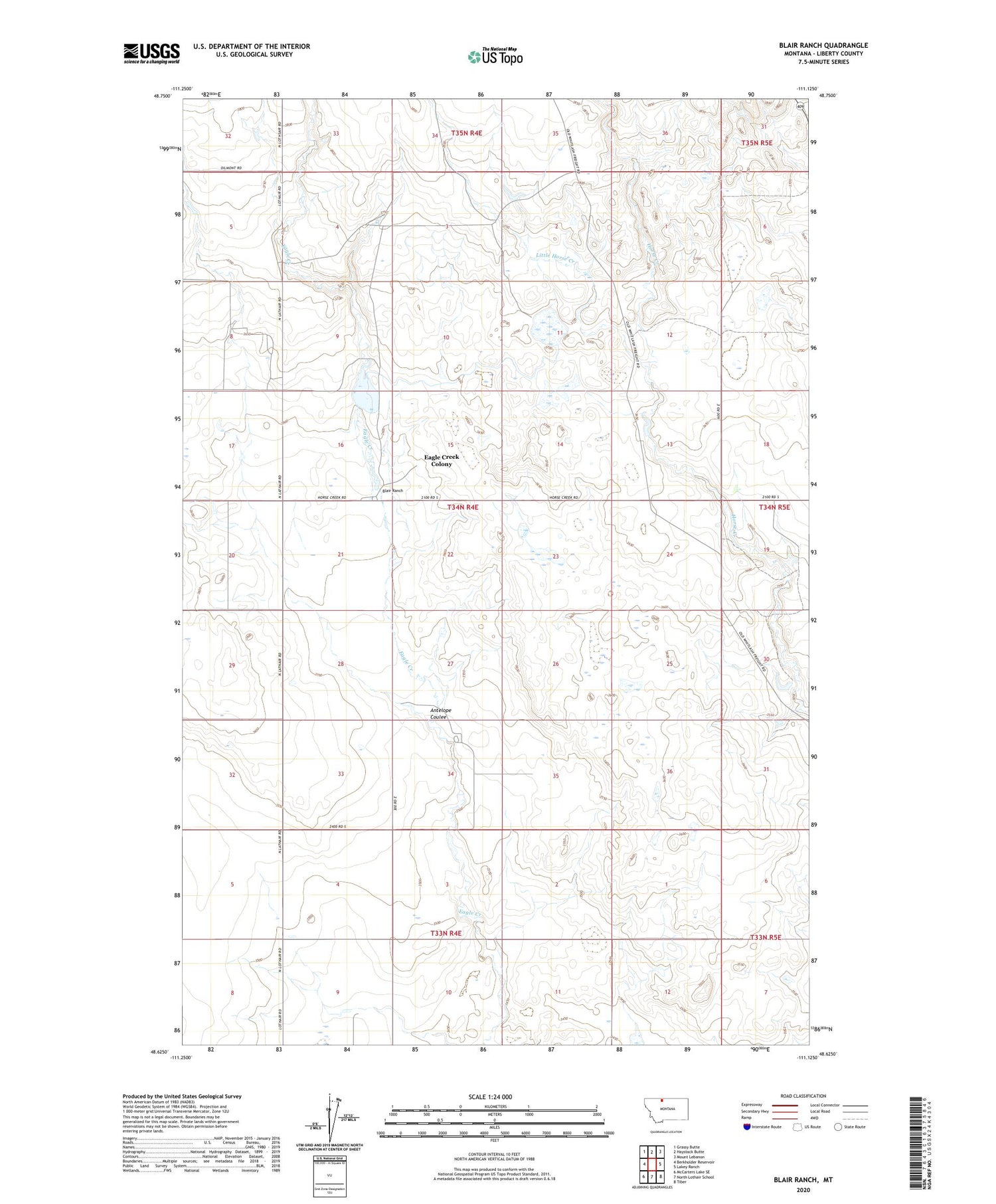
2020 topographic map quadrangle Blair Ranch in the state of Montana. Scale: 1:24000. Based on the newly updated USGS 7.5' US Topo map series, this map is in the following counties: Liberty. The map contains contour data, water features, and other items you are used to seeing on USGS maps, but also has updated roads and other features. This is the next generation of topographic maps. Printed on high-quality waterproof paper with UV fade-resistant inks.
Quads adjacent to this one:
West: Berkholder Reservoir
Northwest: Grassy Butte
North: Haystack Butte
Northeast: Mount Lebanon
East: Lakey Ranch
Southeast: Tiber
South: North Lothair School
Southwest: McCarters Lake SE
Contains the following named places: 33N04E12AAAB01 Well, 34N04E05AAAA01 Well, Antelope Coulee, Blair Number 2 Dam, Blair Ranch, Bourpe and Hamilton Number 1 Dam, Bourpe and Hamilton Reservoir, Doesitall Dam, Eagle Creek Colony, Eagle Creek Colony Census Designated Place, Eagle Creek School, Grandview Oil and Gas Field, Henry Hawks Dam, Liberty Elementary School, Little Horse Creek, Skari and Sons Number 1 Dam, Trinity Church, Trommer Post Office, Trommer School


