MyTopo
Block Mountain Montana US Topo Map
Couldn't load pickup availability
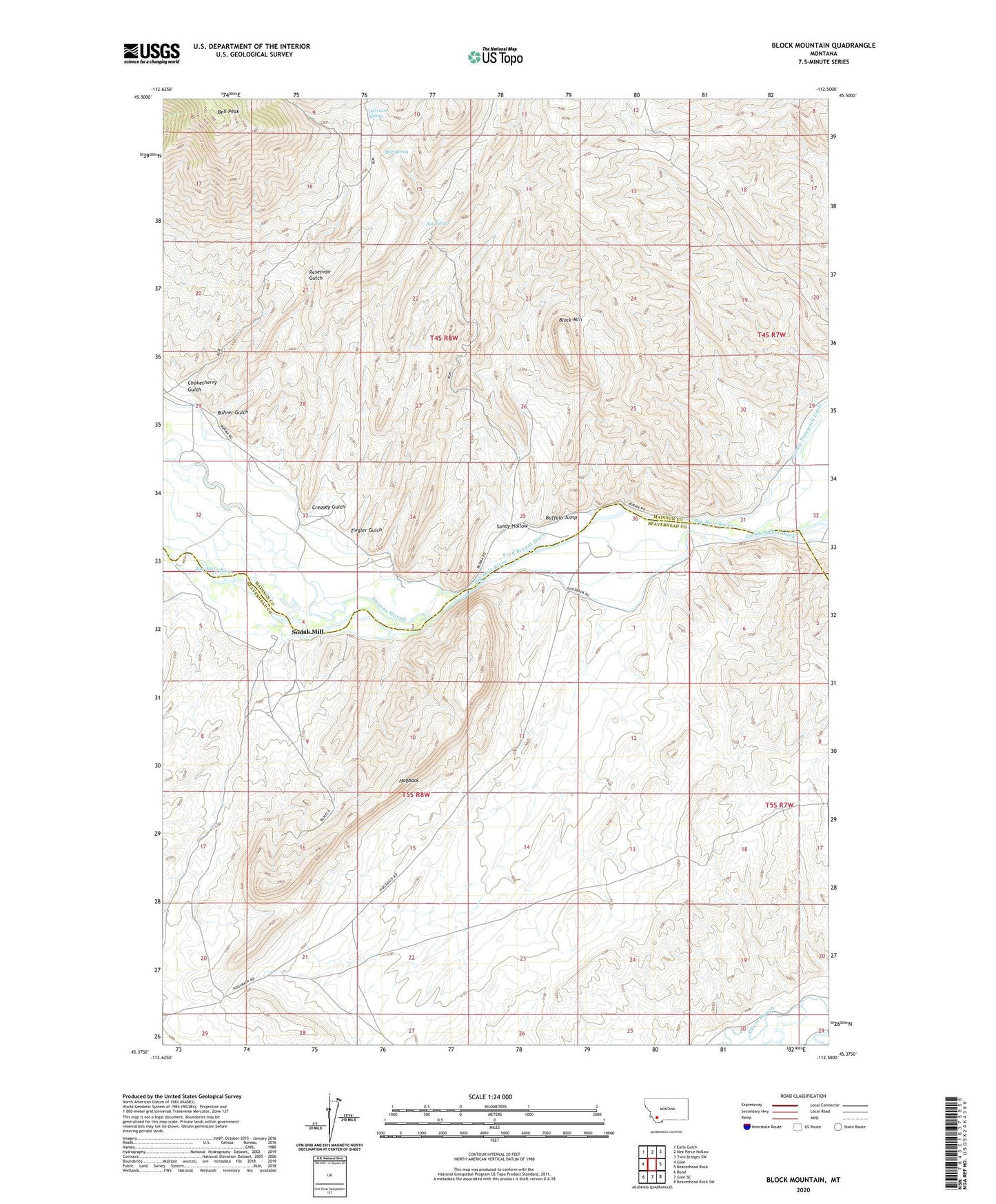
2024 topographic map quadrangle Block Mountain in the state of Montana. Scale: 1:24000. Based on the newly updated USGS 7.5' US Topo map series, this map is in the following counties: Madison, Beaverhead. The map contains contour data, water features, and other items you are used to seeing on USGS maps, but also has updated roads and other features. This is the next generation of topographic maps. Printed on high-quality waterproof paper with UV fade-resistant inks.
Quads adjacent to this one:
West: Glen
Northwest: Earls Gulch
North: Nez Perce Hollow
Northeast: Twin Bridges SW
East: Beaverhead Rock
Southeast: Beaverhead Rock SW
South: Glen SE
Southwest: Bond
This map covers the same area as the classic USGS quad with code o45112d5.
Contains the following named places: 04S07W32CBCB01 Well, Bell Peak, Block Mountain, Box Spring, Buffalo Jump, Buhrer Gulch, Buhrer-Garrison Ditch, Chokecherry Gulch, Cocanougher Ditch, Creasey Gulch, Fred Bryant Ditch, Garrison Spring, Grave of Charles and Emily Buhrer, Hogback, Mill Spring, Notch Bottom Fishing Access Site, Reservoir Gulch, Sandy Hollow, Sodak Mill, Sodak Mine, Stevens Slough, Ziegler Gulch