MyTopo
Clay Butte Montana US Topo Map
Couldn't load pickup availability
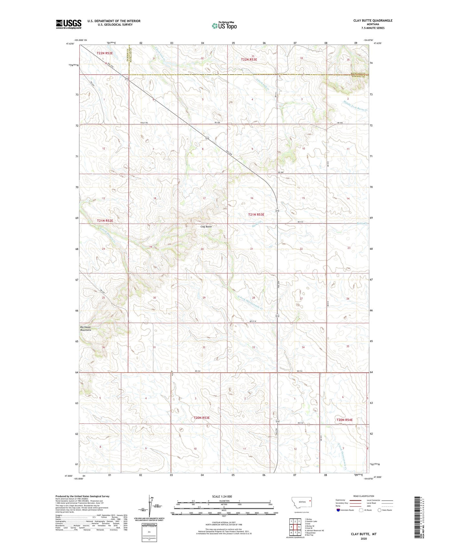
2024 topographic map quadrangle Clay Butte in the state of Montana. Scale: 1:24000. Based on the newly updated USGS 7.5' US Topo map series, this map is in the following counties: Dawson, Richland. The map contains contour data, water features, and other items you are used to seeing on USGS maps, but also has updated roads and other features. This is the next generation of topographic maps. Printed on high-quality waterproof paper with UV fade-resistant inks.
Quads adjacent to this one:
West: Richey SE
Northwest: Richey
North: Kuester Lake
Northeast: Enid
East: Enid SE
Southeast: Red Top
South: Bloomfield
Southwest: Johnson Reservoir NE
This map covers the same area as the classic USGS quad with code o47104e8.
Contains the following named places: 20N53E04DAAA01 Well, 20N53E12BBAB01 Well, 20N54E06DCCA01 Well, 21N53E06CAAA01 Well, 21N53E08ADCC01 Well, 21N53E08CCBB01 Well, 21N53E10BBAD01 Well, 21N53E21CAAB01 Well, 21N53E22DAAB01 Well, 21N53E29ADAD01 Well, 22N53E35CCCD01 Well, Bethlehem Church, Clay Butte, Divide School, Fairview School, Victory School, Ziegler School