MyTopo
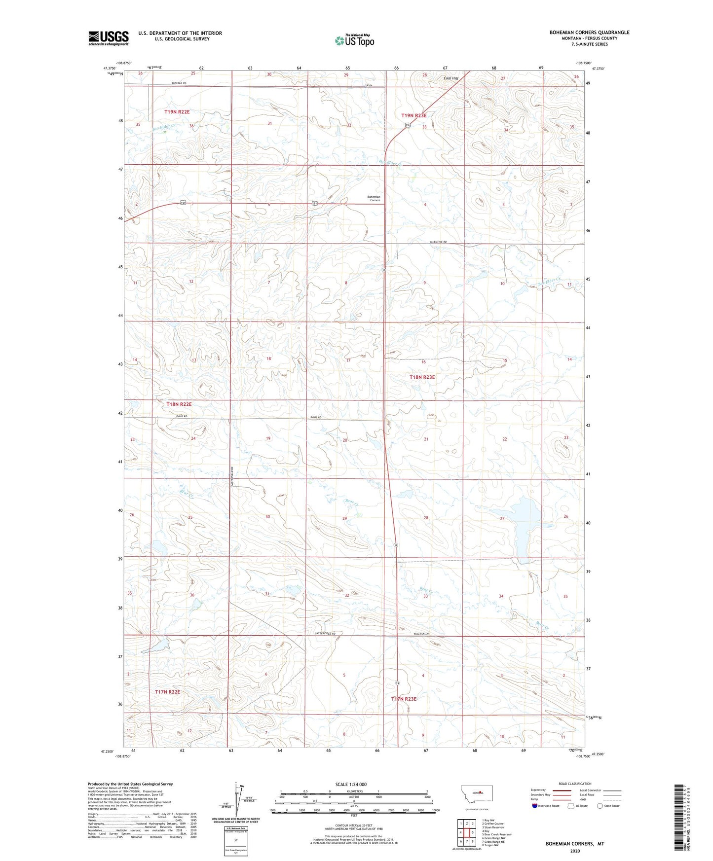
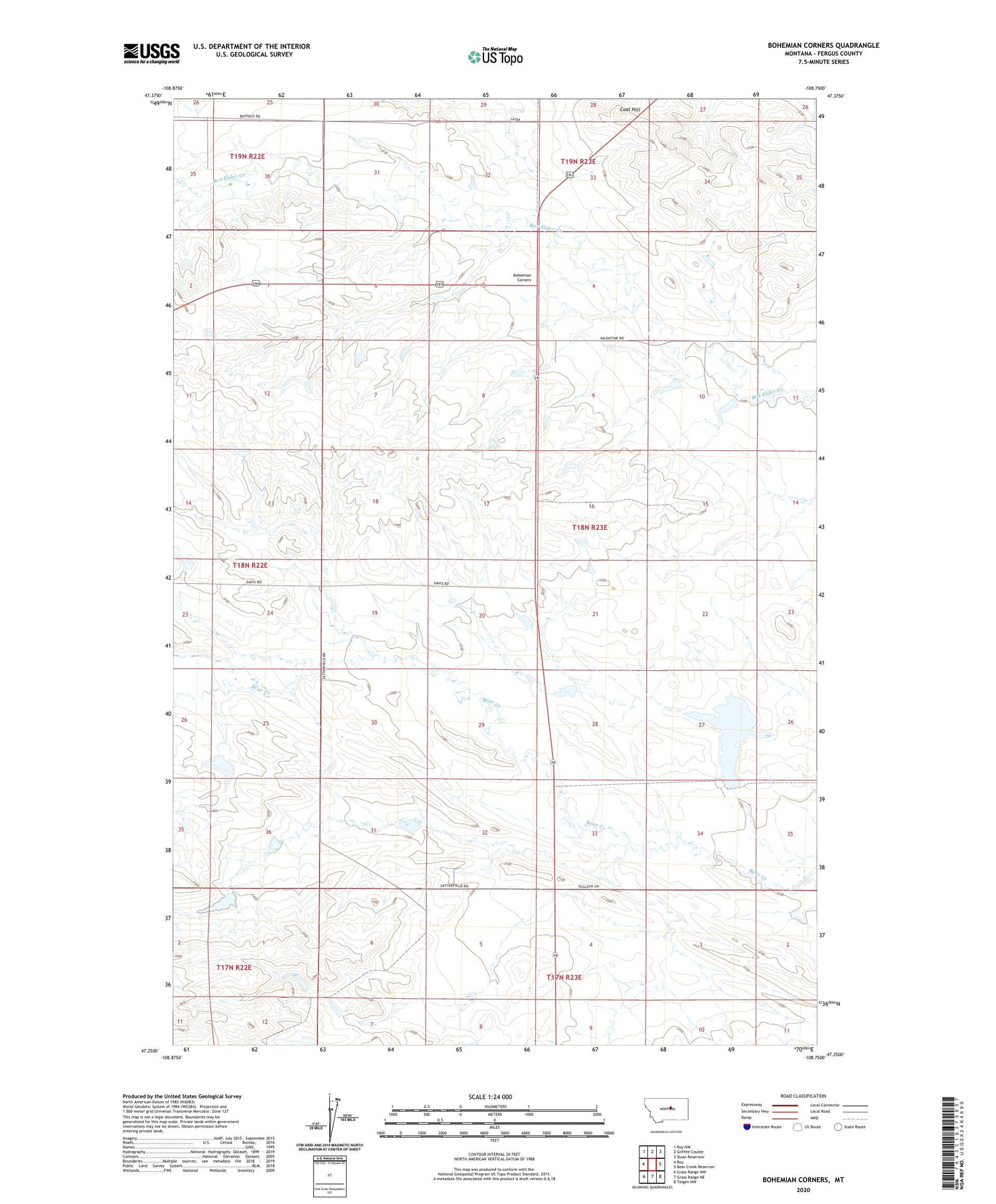
Bohemian Corners Montana US Topo Map
Couldn't load pickup availability
2020 topographic map quadrangle Bohemian Corners in the state of Montana. Scale: 1:24000. Based on the newly updated USGS 7.5' US Topo map series, this map is in the following counties: Fergus. The map contains contour data, water features, and other items you are used to seeing on USGS maps, but also has updated roads and other features. This is the next generation of topographic maps. Printed on high-quality waterproof paper with UV fade-resistant inks.
Quads adjacent to this one:
West: Roy
Northwest: Roy NW
North: Griffee Coulee
Northeast: Sloan Reservoir
East: Bear Creek Reservoir
Southeast: Teigen NW
South: Grass Range NE
Southwest: Grass Range NW
Contains the following named places: 06N23E02DABD01 Well, 17N23E06ACA_01 Well, 18N22E01AAC_01 Well, 18N22E01AD__01 Well, 18N23E10ABA_01 Well, Auburn Post Office, Bohemian Corner School, Bohemian Corners, Boulevard School, Butte View School, Christensen School, Coal Hill, Helluva Dam, Iowa Bench School, Kindle Number 2 Dam, L Adams Dam, Lindstrom Post Office, State Bear Dam