MyTopo
Roy NW Montana US Topo Map
Couldn't load pickup availability
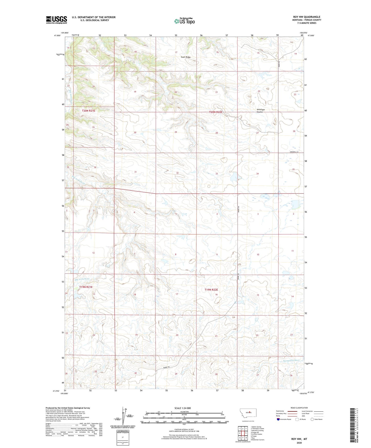
2024 topographic map quadrangle Roy NW in the state of Montana. Scale: 1:24000. Based on the newly updated USGS 7.5' US Topo map series, this map is in the following counties: Fergus. The map contains contour data, water features, and other items you are used to seeing on USGS maps, but also has updated roads and other features. This is the next generation of topographic maps. Printed on high-quality waterproof paper with UV fade-resistant inks.
Quads adjacent to this one:
West: Fergus NE
Northwest: Bakers Spring
North: Thompson Coulee
Northeast: Mitchell Crossing
East: Griffee Coulee
Southeast: Bohemian Corners
South: Roy
Southwest: Fergus
This map covers the same area as the classic USGS quad with code o47108d8.
Contains the following named places: 19N22E06CCD_01 Well, 20N22E14CCC_01 Well, 20N22E23CAC_01 Well, Dry Armells School, Fink Reservoir Dam, Hey Joe Reservoir Dam, Mabee Dam, Snell Ridge, Too Far Gone Dam, Zuley Post Office, Zuley School