MyTopo
Wilson Gulch Montana US Topo Map
Couldn't load pickup availability
Also explore the Wilson Gulch Forest Service Topo of this same quad for updated USFS data
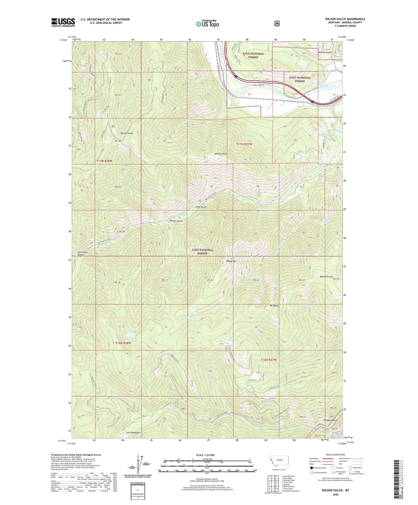
2024 topographic map quadrangle Wilson Gulch in the state of Montana. Scale: 1:24000. Based on the newly updated USGS 7.5' US Topo map series, this map is in the following counties: Mineral. The map contains contour data, water features, and other items you are used to seeing on USGS maps, but also has updated roads and other features. This is the next generation of topographic maps. Printed on high-quality waterproof paper with UV fade-resistant inks.
Quads adjacent to this one:
West: Torino Peak
Northwest: Boyd Mountain
North: Saint Regis
Northeast: Keystone Peak
East: Superior
Southeast: Landowner Mountain
South: Illinois Peak
Southwest: Sherlock Peak
This map covers the same area as the classic USGS quad with code o47115b1.
Contains the following named places: Ann Arbor Gulch, Bear Creek, Bear Creek Mine, Blacktail Mountain, Bouchard Lake, Cayuse, Cayuse Saddle, Cedar Creek Stock Driveway, Cedar Junction, Cedar Junction Post Office, Dry Creek Cabin Site, Dry Fork Dry Creek, Dry Fork Mine, Lime Gulch, Lincoln City, Lost Creek, Lost Meadows, Marble Creek, Marble Point, Mount Baldy, Pierson Creek, Reeves Creek, Sheep Mountain, Sloway Campground, Wilson Gulch, Wilson Lake