MyTopo
Bracket Butte SE Montana US Topo Map
Couldn't load pickup availability
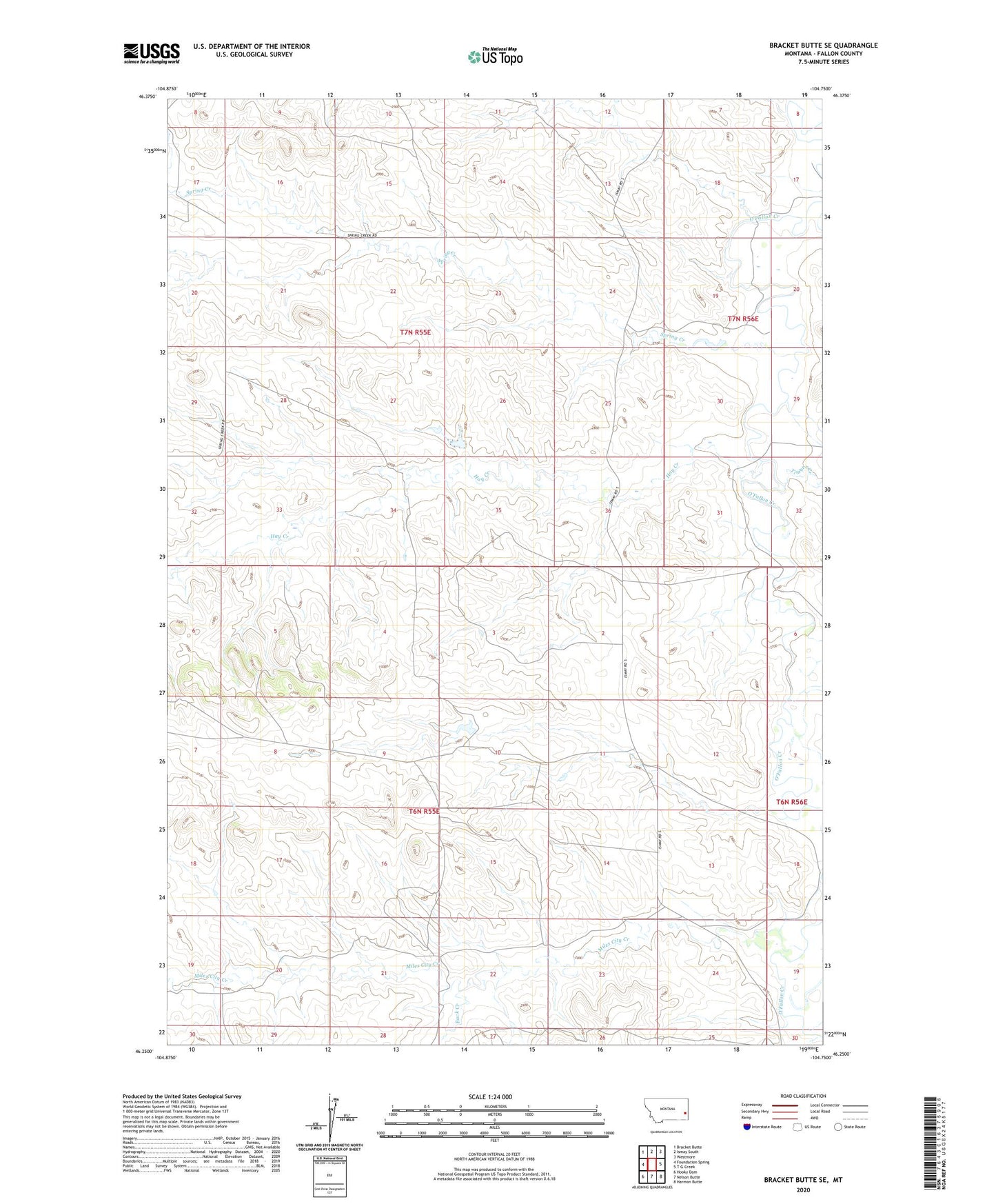
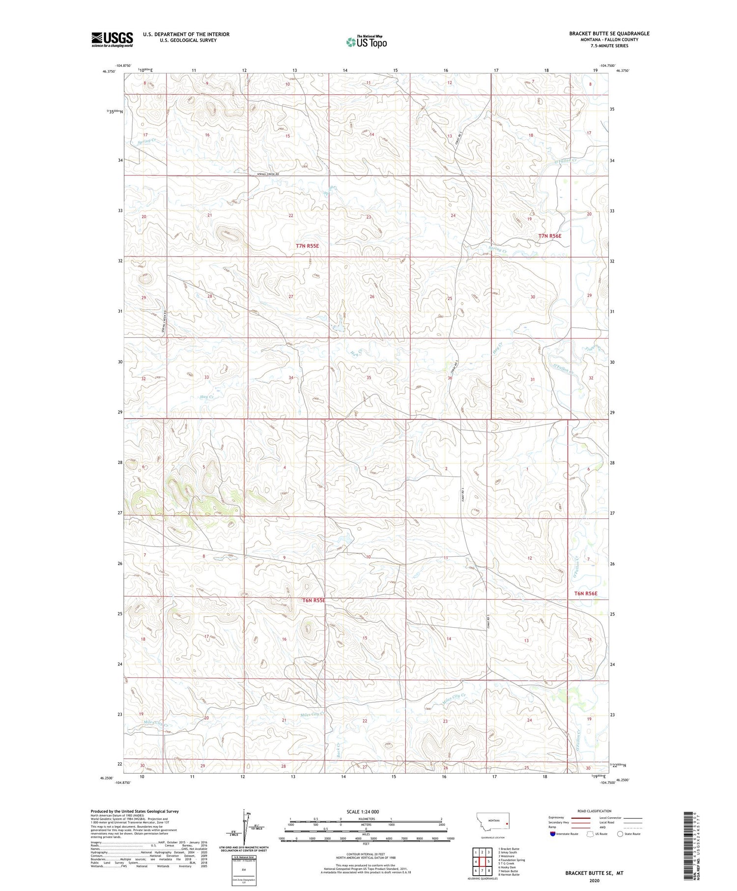
2020 topographic map quadrangle Bracket Butte SE in the state of Montana. Scale: 1:24000. Based on the newly updated USGS 7.5' US Topo map series, this map is in the following counties: Fallon. The map contains contour data, water features, and other items you are used to seeing on USGS maps, but also has updated roads and other features. This is the next generation of topographic maps. Printed on high-quality waterproof paper with UV fade-resistant inks.
Quads adjacent to this one:
West: Foundation Spring
Northwest: Bracket Butte
North: Ismay South
Northeast: Westmore
East: T G Creek
Southeast: Harmon Butte
South: Nelson Butte
Southwest: Hooky Dam
Contains the following named places: 06N55E14A___01 Well, 06N55E23ABDA01 Well, 06N55E23BA__01 Well, 06N55E24BB__01 Well, 06N56E19CA__01 Well, 06N56E30BB__01 Well, 07N55E16CC__01 Well, 07N55E22AA__01 Well, 07N55E22AADA01 Well, 07N55E28BB__01 Well, 07N56E08CC__01 Well, 07N56E20CC__01 Well, Back Creek, Hay Creek, Miles City Creek, Savage Dam, Scroggin Creek, Spring Creek, Timber Creek