MyTopo
Sioux Pass Montana US Topo Map
Couldn't load pickup availability
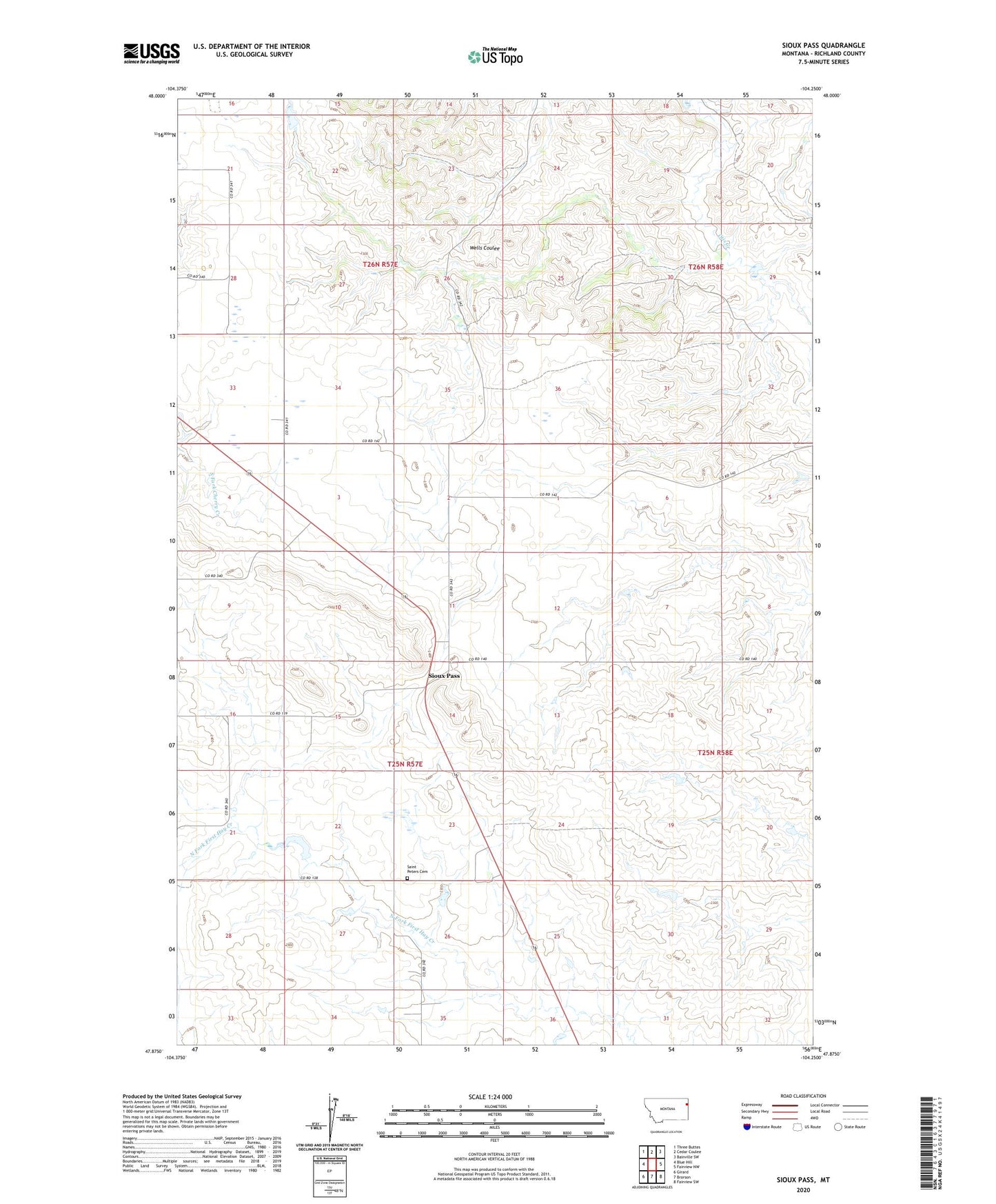
2024 topographic map quadrangle Sioux Pass in the state of Montana. Scale: 1:24000. Based on the newly updated USGS 7.5' US Topo map series, this map is in the following counties: Richland. The map contains contour data, water features, and other items you are used to seeing on USGS maps, but also has updated roads and other features. This is the next generation of topographic maps. Printed on high-quality waterproof paper with UV fade-resistant inks.
Quads adjacent to this one:
West: Blue Hill
Northwest: Three Buttes
North: Cedar Coulee
Northeast: Bainville SW
East: Fairview NW
Southeast: Fairview SW
South: Brorson
Southwest: Girard
This map covers the same area as the classic USGS quad with code o47104h3.
Contains the following named places: 25N57E02BDDC01 Well, 25N57E09BBDA01 Well, 25N57E26AAAB01 Well, 25N57E27BBA_01 Well, A Peterson Dam, C Sowle Reservoir Number 2 Dam, Elroy Dam, Leo Dam, Peterson Dam, Saint Peters Cemetery, Saint Peters Church, Sioux Pass, Sioux Pass Post Office, Sioux Pass School