MyTopo
Brush Mountain SW Montana US Topo Map
Couldn't load pickup availability
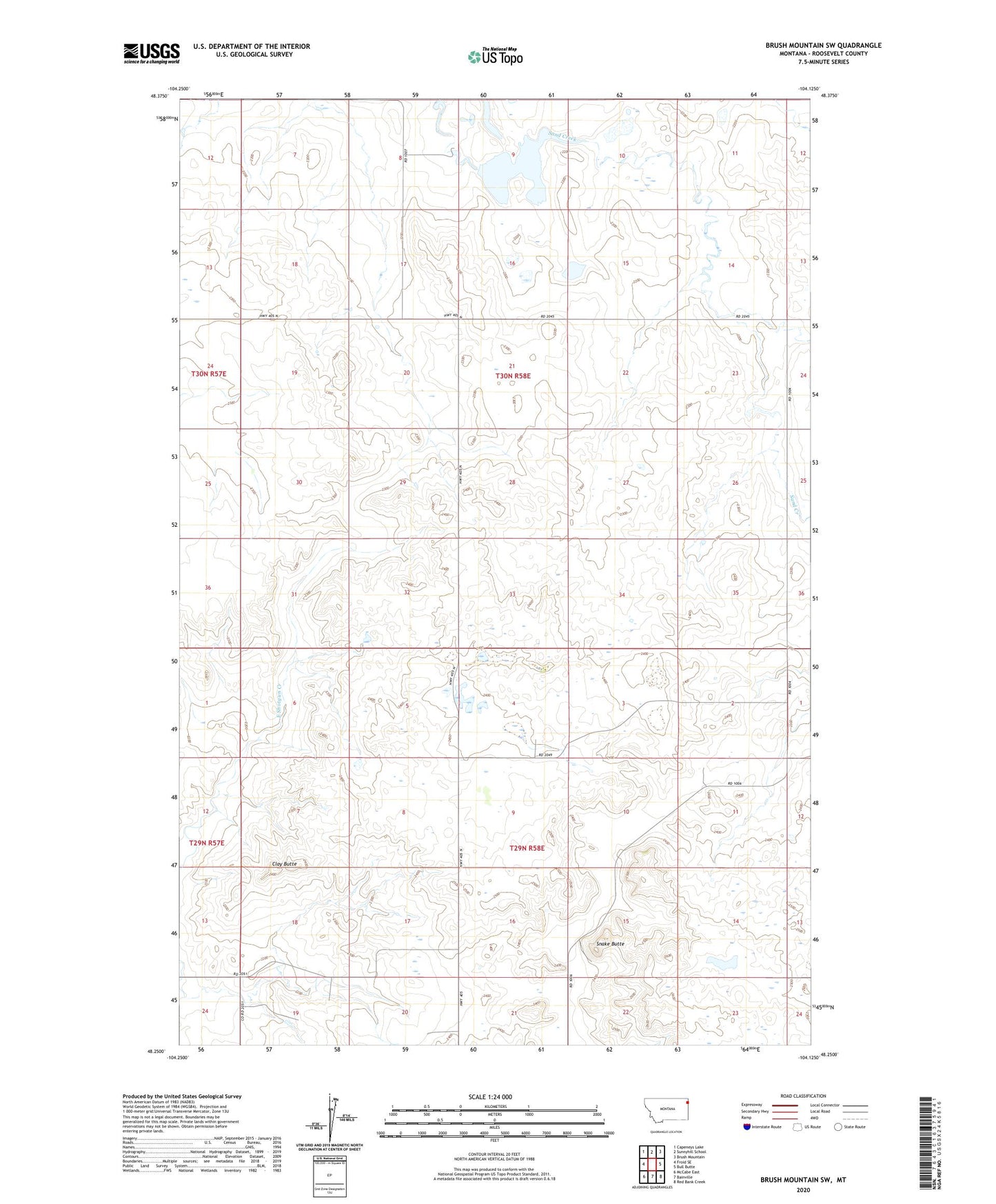
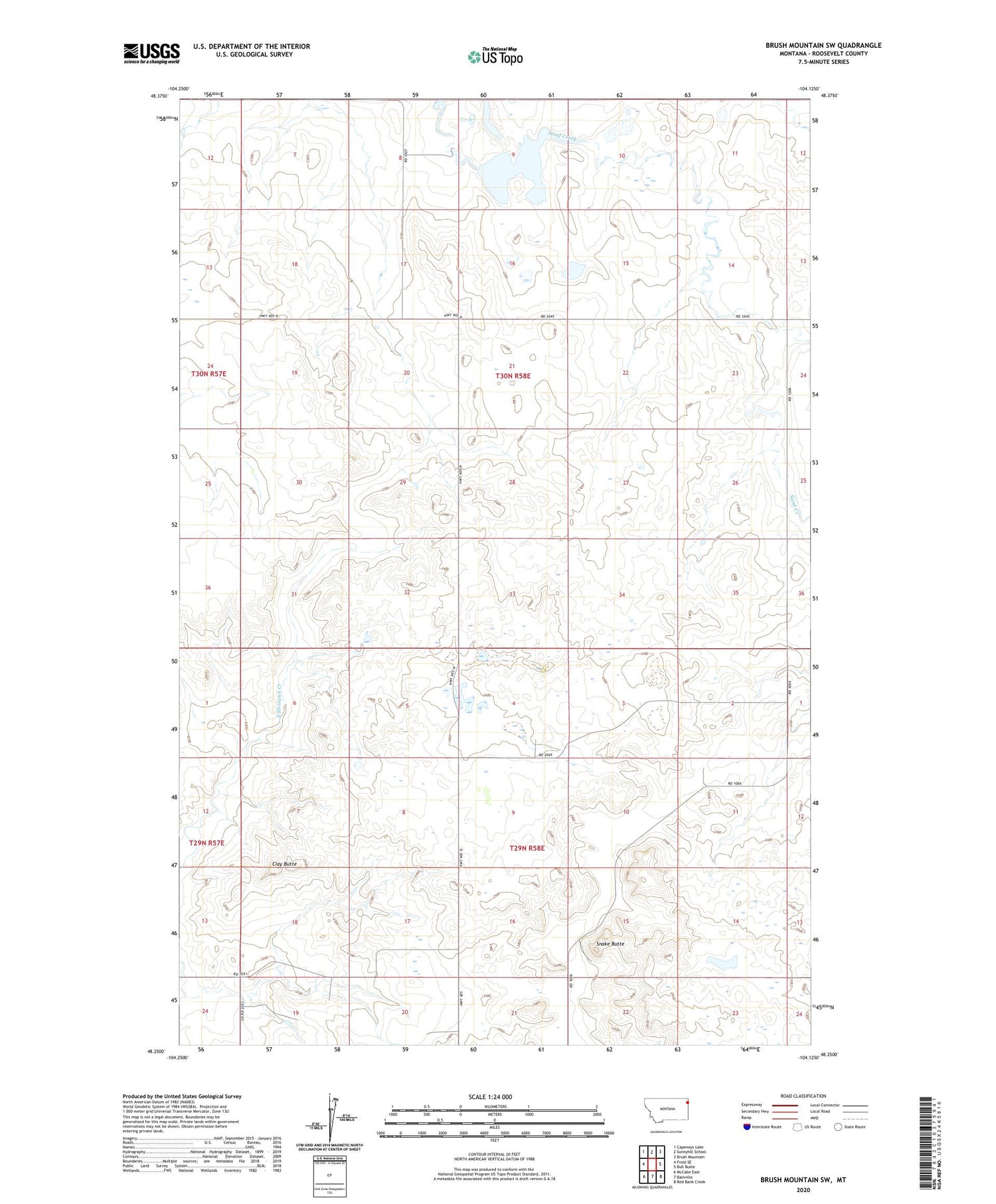
2020 topographic map quadrangle Brush Mountain SW in the state of Montana. Scale: 1:24000. Based on the newly updated USGS 7.5' US Topo map series, this map is in the following counties: Roosevelt. The map contains contour data, water features, and other items you are used to seeing on USGS maps, but also has updated roads and other features. This is the next generation of topographic maps. Printed on high-quality waterproof paper with UV fade-resistant inks.
Quads adjacent to this one:
West: Froid SE
Northwest: Capeneys Lake
North: Sunnyhill School
Northeast: Brush Mountain
East: Bull Butte
Southeast: Red Bank Creek
South: Bainville
Southwest: McCabe East
Contains the following named places: 29N58E03CDCC01 Well, 30N58E27CCDB01 Well, Burgett School, Clay Butte, Huso School, Picard Dam, Rosedale School, Snake Butte, Teepee Creeper Dam