MyTopo
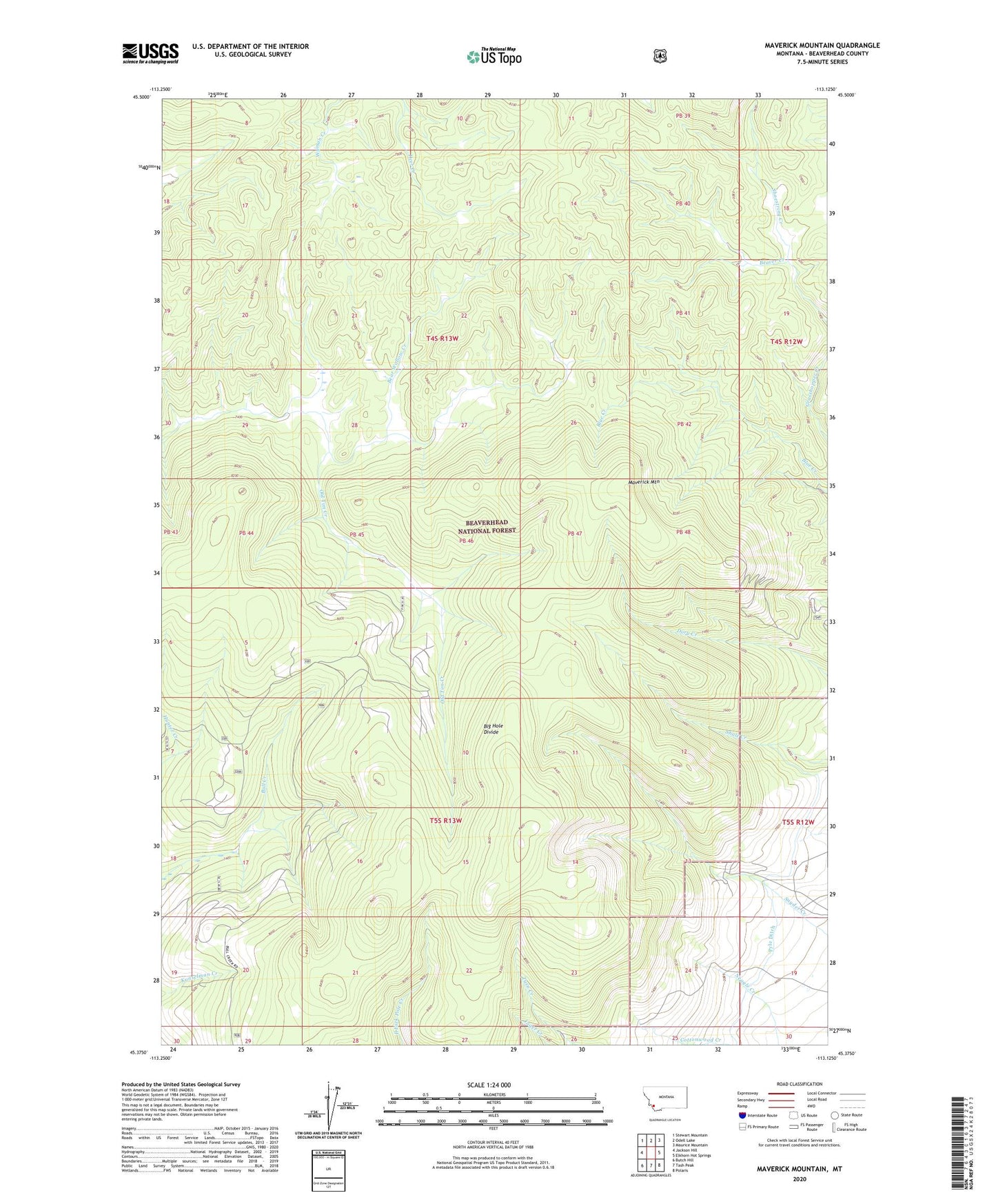
Maverick Mountain Montana US Topo Map
Couldn't load pickup availability
Also explore the Maverick Mountain Forest Service Topo of this same quad for updated USFS data
2024 topographic map quadrangle Maverick Mountain in the state of Montana. Scale: 1:24000. Based on the newly updated USGS 7.5' US Topo map series, this map is in the following counties: Beaverhead. The map contains contour data, water features, and other items you are used to seeing on USGS maps, but also has updated roads and other features. This is the next generation of topographic maps. Printed on high-quality waterproof paper with UV fade-resistant inks.
Quads adjacent to this one:
West: Jackson Hill
Northwest: Stewart Mountain
North: Odell Lake
Northeast: Maurice Mountain
East: Elkhorn Hot Springs
Southeast: Polaris
South: Tash Peak
Southwest: Butch Hill
This map covers the same area as the classic USGS quad with code o45113d2.
Contains the following named places: Bear Wallow Creek, Beaver Creek, Blue Creek Trail, Bull Creek Polecreek Trail, Maverick Mountain, Maverick Mountain Ski Area, Old Tim Creek Trail, Pole Creek Trail, Pyle Ditch, Shoestring Creek Bear Wallow Creek Trail