MyTopo
Capitol Mountain Montana US Topo Map
Couldn't load pickup availability
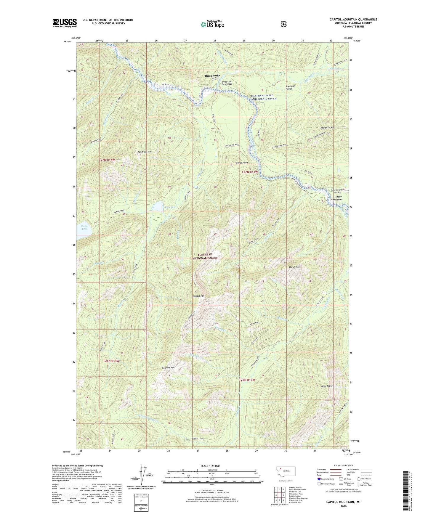
2020 topographic map quadrangle Capitol Mountain in the state of Montana. Scale: 1:24000. Based on the newly updated USGS 7.5' US Topo map series, this map is in the following counties: Flathead. The map contains contour data, water features, and other items you are used to seeing on USGS maps, but also has updated roads and other features. This is the next generation of topographic maps. Printed on high-quality waterproof paper with UV fade-resistant inks.
Quads adjacent to this one:
West: Horseshoe Peak
Northwest: Mount Bradley
North: Red Plume Mountain
Northeast: Crescent Cliff
East: Gable Peaks
Southeast: Trilobite Peak
South: Whitcomb Peak
Southwest: Spotted Bear Mountain
Contains the following named places: Bore Creek, Bradley Creek, Brushshack Creek, Capitol Creek, Capitol Mountain, Dryad Creek, Guard Creek, Helmet Point, Lake Creek, Lodgepole Creek, Miner Creek, Miner Creek Trail, Morrison Creek, Porter Creek, Rambler Creek, Roaring Creek, Rouge Creek, Schafer Creek, Scott Lake, Soakem Mountain, Three Forks, Three Forks Pack Bridge, Union Mountain, Wildrose Mountain