MyTopo
Capitol Rock Montana US Topo Map
Couldn't load pickup availability
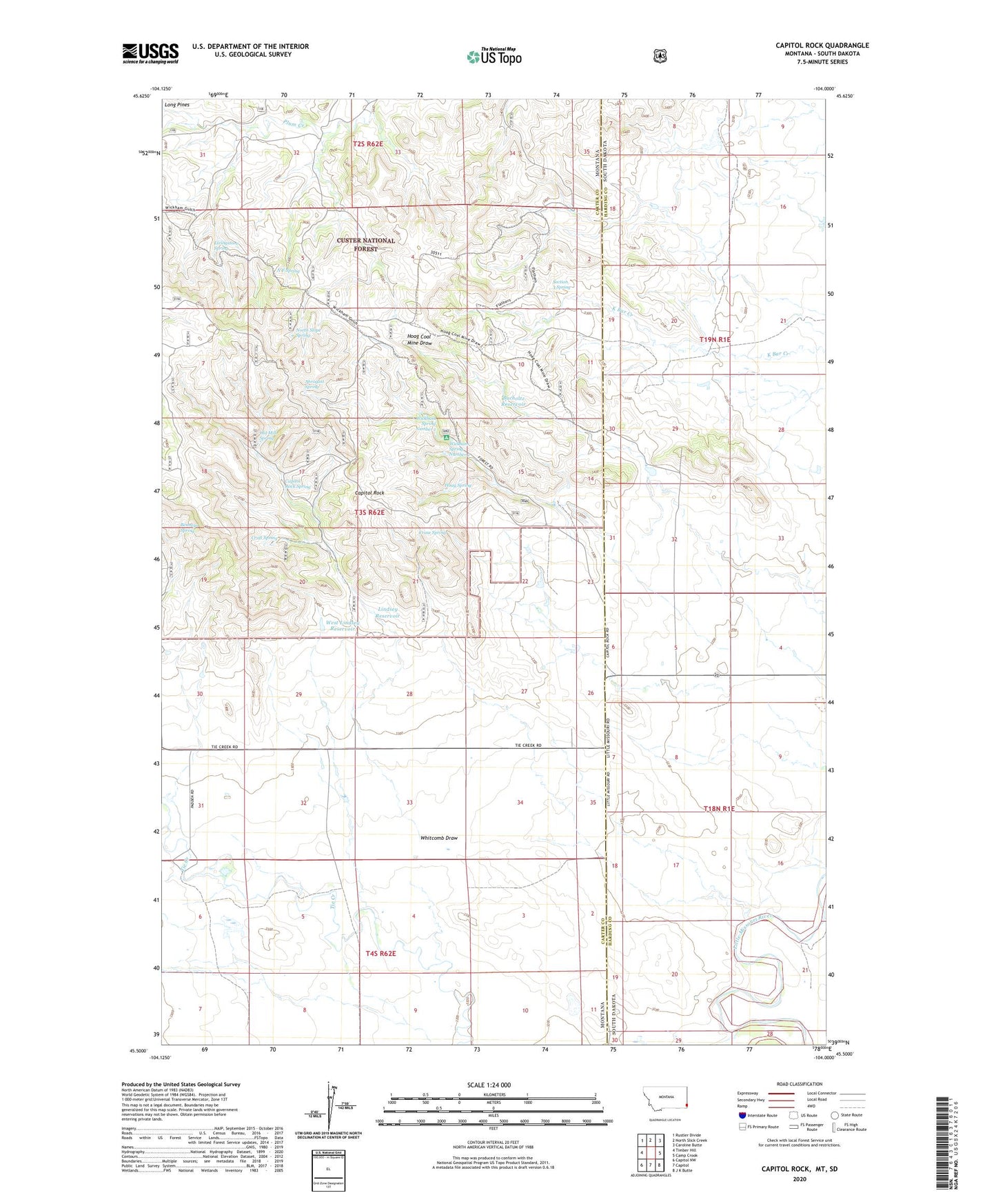
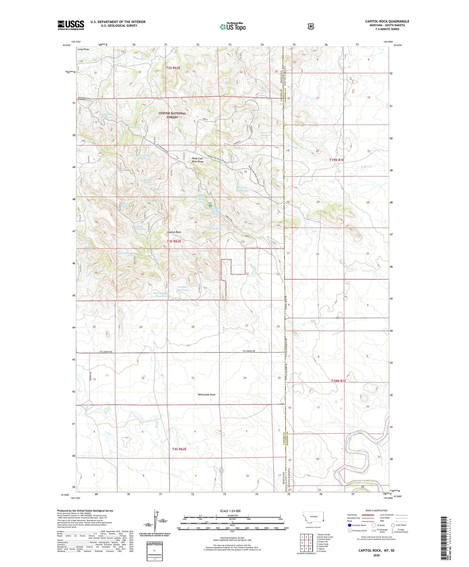
2020 topographic map quadrangle Capitol Rock in the states of Montana, South Dakota. Scale: 1:24000. Based on the newly updated USGS 7.5' US Topo map series, this map is in the following counties: Carter, Harding. The map contains contour data, water features, and other items you are used to seeing on USGS maps, but also has updated roads and other features. This is the next generation of topographic maps. Printed on high-quality waterproof paper with UV fade-resistant inks.
Quads adjacent to this one:
West: Timber Hill
Northwest: Rustler Divide
North: North Slick Creek
Northeast: Caroline Butte
East: Camp Crook
Southeast: J K Butte
South: Capitol
Southwest: Capitol NW
Contains the following named places: 03S62E22ABAA01 Well, Abrogast Spring, Benneys Spring, Blocker Field, Bucholtz Reservoir, Capitol Rock, Capitol Rock Spring, Catron Well, Craft Spring, Crase Spring, D Rayman Ranch, Hoag Spring, Lindsey Reservoir, Livingstone Spring, N F Spring, North Fork Plum Creek, North Slope Spring, Old Mill Spring, Plainview School, Section 3 Spring, Turbiville Irrigation Dam, West Lindsey Reservoir, West Lindsey Reservoir Dam, Whitcomb Draw, Wickham Gulch Campground, Wickham Spring Number 1, Wickham Spring Number 2