MyTopo
Timber Hill Montana US Topo Map
Couldn't load pickup availability
Also explore the Timber Hill Forest Service Topo of this same quad for updated USFS data
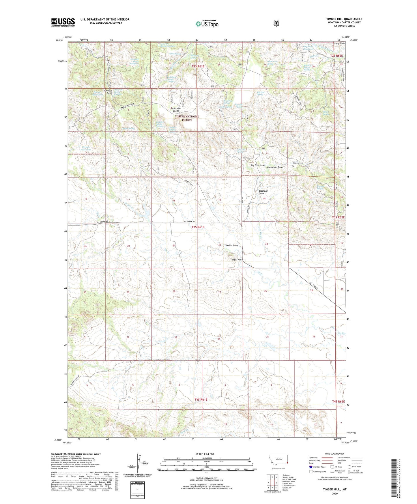
2024 topographic map quadrangle Timber Hill in the state of Montana. Scale: 1:24000. Based on the newly updated USGS 7.5' US Topo map series, this map is in the following counties: Carter. The map contains contour data, water features, and other items you are used to seeing on USGS maps, but also has updated roads and other features. This is the next generation of topographic maps. Printed on high-quality waterproof paper with UV fade-resistant inks.
Quads adjacent to this one:
West: Belltower Butte
Northwest: Belltower
North: Rustler Divide
Northeast: North Slick Creek
East: Capitol Rock
Southeast: Capitol
South: Capitol NW
Southwest: Lone Tree Creek
This map covers the same area as the classic USGS quad with code o45104e2.
Contains the following named places: 03S61E24CDBD01 Well, 04S61E03CACC01 Well, Ballinger Spring, Belltower Divide, Big Noise Spring, Big Tree Draw, Big Tree Spring, Blacktail Draw, Brewer Reservoir, Cheesman Draw, Curley Spring, Double F Spring Number 1, Double F Spring Number 2, Gergen Creek, Gergen Reservoir, Gergen Spring, German Number 2 Dam, Icebox Spring, Lost Farm Spring Number 1, Lost Farm Spring Number 2, Maverick Spring Number 1, Maverick Spring Number 2, McClary Ranger Station, McClary Spring Number 1, North Tie Creek, Padden Number 2 Dam, Picnic Spring, Pioneer Cemetery, Pot Hole Reservoir, Rema Post Office, Rema School, Sawdust Spring, Sawmill Spring, Tie Creek School, Timber Hill, V Bar M Spring, Weller Draw, White Rock Spring