
MyTopo
Cascade Montana US Topo Map
Couldn't load pickup availability
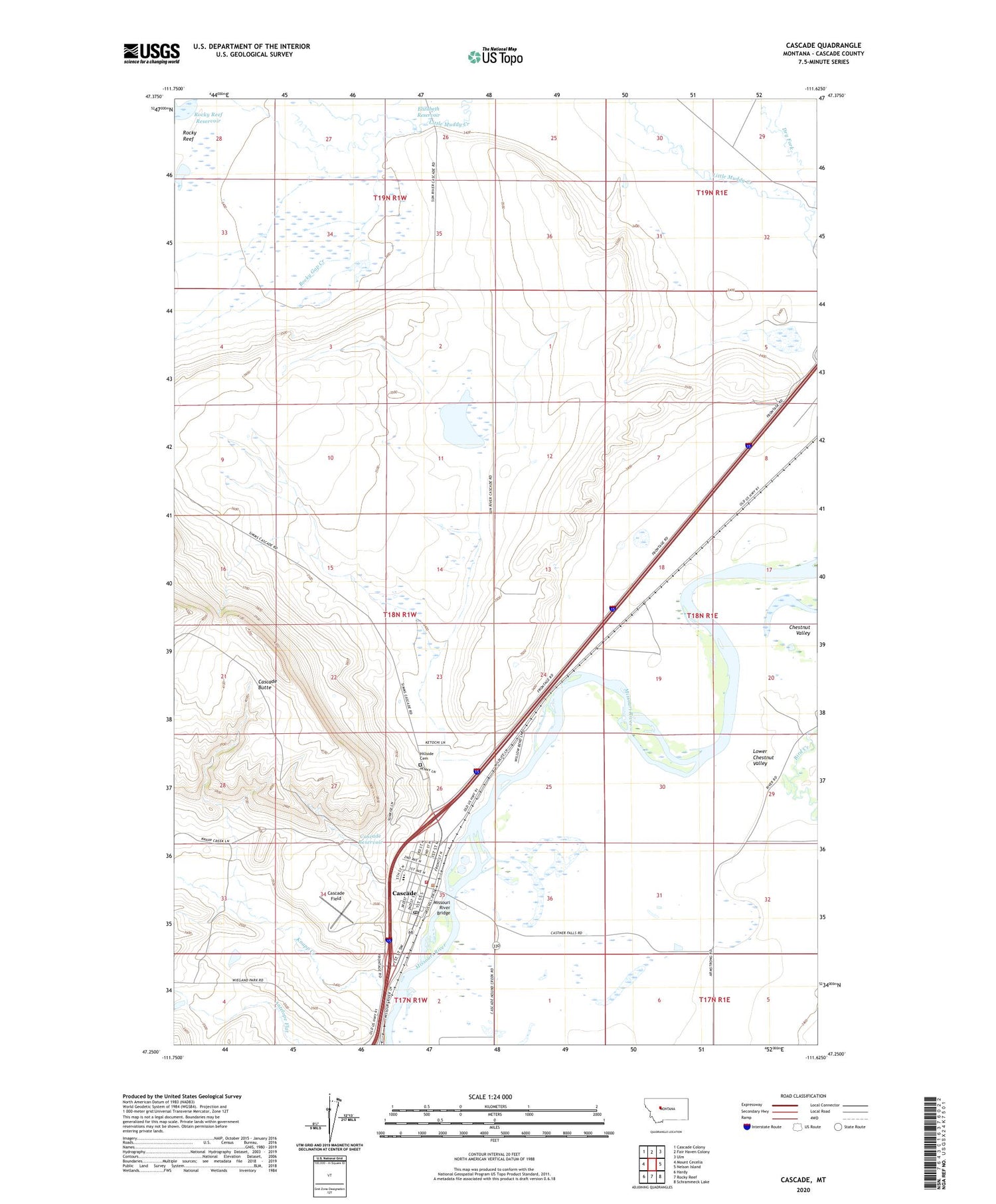
2020 topographic map quadrangle Cascade in the state of Montana. Scale: 1:24000. Based on the newly updated USGS 7.5' US Topo map series, this map is in the following counties: Cascade. The map contains contour data, water features, and other items you are used to seeing on USGS maps, but also has updated roads and other features. This is the next generation of topographic maps. Printed on high-quality waterproof paper with UV fade-resistant inks.
Quads adjacent to this one:
West: Mount Cecelia
Northwest: Cascade Colony
North: Fair Haven Colony
Northeast: Ulm
East: Nelson Island
Southeast: Schrammeck Lake
South: Rocky Reef
Southwest: Hardy
Contains the following named places: 17N01E05C___01 Well, 17N01E06A___01 Well, 18N01E05B___01 Well, 18N01E19B___01 Well, 18N01E19B___02 Well, 18N01E20D___01 Well, 18N01E29D___01 Well, 18N01E29D___02 Well, 18N01E29D___03 Well, 18N01E30B___01 Well, 18N01W01C___01 Well, 18N01W11B___01 Well, 18N01W11B___02 Well, 18N01W12B___01 Spring, 18N01W13____01 Well, 18N01W13____02 Well, 18N01W13B___01 Spring, 18N01W13C___01 Well, 18N01W13C___02 Well, 18N01W15B___01 Well, 18N01W16D___01 Spring, 18N01W21B___01 Well, 18N01W23D___01 Well, 18N01W24C___01 Well, 18N01W26____01 Well, 18N01W26B___01 Well, 18N01W27A___01 Spring, 18N01W27C___01 Spring, 18N01W27C___02 Spring, 18N01W27C___03 Spring, 18N01W27C___04 Spring, 18N01W27C___05 Spring, 18N01W35____01 Well, 18N01W35____02 Well, 18N01W35A___01 Well, 18N01W35B___01 Well, 18N01W35C___01 Well, 18N01W35D___01 Well, 18N01W35D___02 Well, Cascade, Cascade Airport, Cascade Field, Cascade Hospital, Cascade Post Office, Cascade Reservoir, Cascade School, Cascade Stock Yards, Cascade Trailer Park, Cascade Volunteer Fire Department, Church of Christ, Community United Methodist Church of Cascade, Dodge, Dry Fork, Elizabeth Reservoir, Farmer Rancher Fire Volunteer Fire Department, Hillside Cemetery, Knapp Creek, Lower Chestnut Valley, Missouri River Bridge, Rocky Gap Creek, Rocky Reef, Sacred Heart Catholic Church, Saint Clair, Saint Clair Methodist Church, Saint Clair Post Office, Saint Clair School, The Church of Jesus Christ of Latter Day Saints, Town of Cascade, Webb Number 1 Dam, Wedsworth Memorial Library, Yucca Golf Club


