MyTopo
Cascade Colony Montana US Topo Map
Couldn't load pickup availability
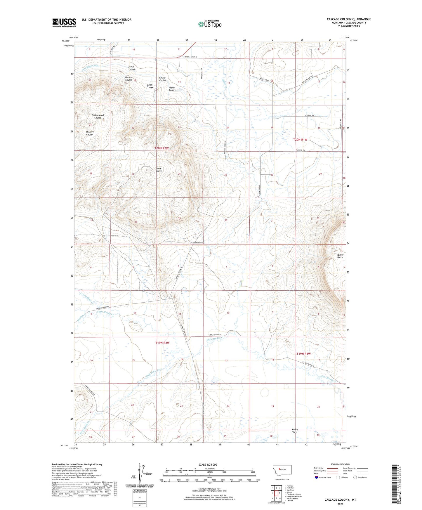
2024 topographic map quadrangle Cascade Colony in the state of Montana. Scale: 1:24000. Based on the newly updated USGS 7.5' US Topo map series, this map is in the following counties: Cascade. The map contains contour data, water features, and other items you are used to seeing on USGS maps, but also has updated roads and other features. This is the next generation of topographic maps. Printed on high-quality waterproof paper with UV fade-resistant inks.
Quads adjacent to this one:
West: Simms
Northwest: Fairfield
North: Fort Shaw
Northeast: Sun River
East: Fair Haven Colony
Southeast: Cascade
South: Mount Cecelia
Southwest: Telegraph Mountain
This map covers the same area as the classic USGS quad with code o47111d7.
Contains the following named places: 19N02W13A___01 Well, 20N02W33____01 Well, Birdtail Creek, Cascade Colony, Cascade Colony Census Designated Place, Cascade Colony School, Crown Butte Creek, Fjeld Coulee, Fort Shaw Census Designated Place, Hanson Coulee, Kolsta Coulee, Muddy Creek School, Muddy Flats, O'Neil Coulee, Palo Ranch, Prevo Coulee, Saint Johns Creek, Seaton Ranch, Shaw Butte, Square Butte School, Sun River Valley Division, Whiskey Browns Trading Post