MyTopo
Mount Cecelia Montana US Topo Map
Couldn't load pickup availability
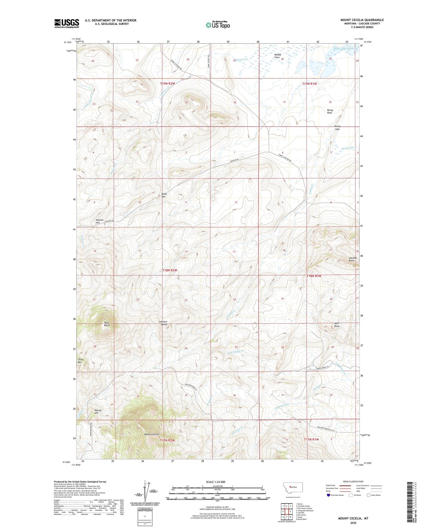
2024 topographic map quadrangle Mount Cecelia in the state of Montana. Scale: 1:24000. Based on the newly updated USGS 7.5' US Topo map series, this map is in the following counties: Cascade. The map contains contour data, water features, and other items you are used to seeing on USGS maps, but also has updated roads and other features. This is the next generation of topographic maps. Printed on high-quality waterproof paper with UV fade-resistant inks.
Quads adjacent to this one:
West: Telegraph Mountain
Northwest: Simms
North: Cascade Colony
Northeast: Fair Haven Colony
East: Cascade
Southeast: Rocky Reef
South: Hardy
Southwest: Mid Canon
This map covers the same area as the classic USGS quad with code o47111c7.
Contains the following named places: 17N01W05A___01 Well, 17N01W06B___01 Spring, 18N01W07C___01 Well, 18N01W07D___01 Well, 18N01W18C___01 Well, 18N01W29C___01 Spring, 18N01W31A___01 Well, 18N01W31A___02 Well, 18N01W32A___01 Well, Cascade Butte, China Mountain, Dime Hill, Hunters Creek, Johnson Butte, Lepley Creek, Mission Hill, Mount Cecelia, North Branch Knapp Creek, Rocky Gap, Rocky Reef Reservoir, Skull Butte, Spun Dam, Taylor School, Warner Hill, Wolf Point, Yaklich School