MyTopo
Fair Haven Colony Montana US Topo Map
Couldn't load pickup availability
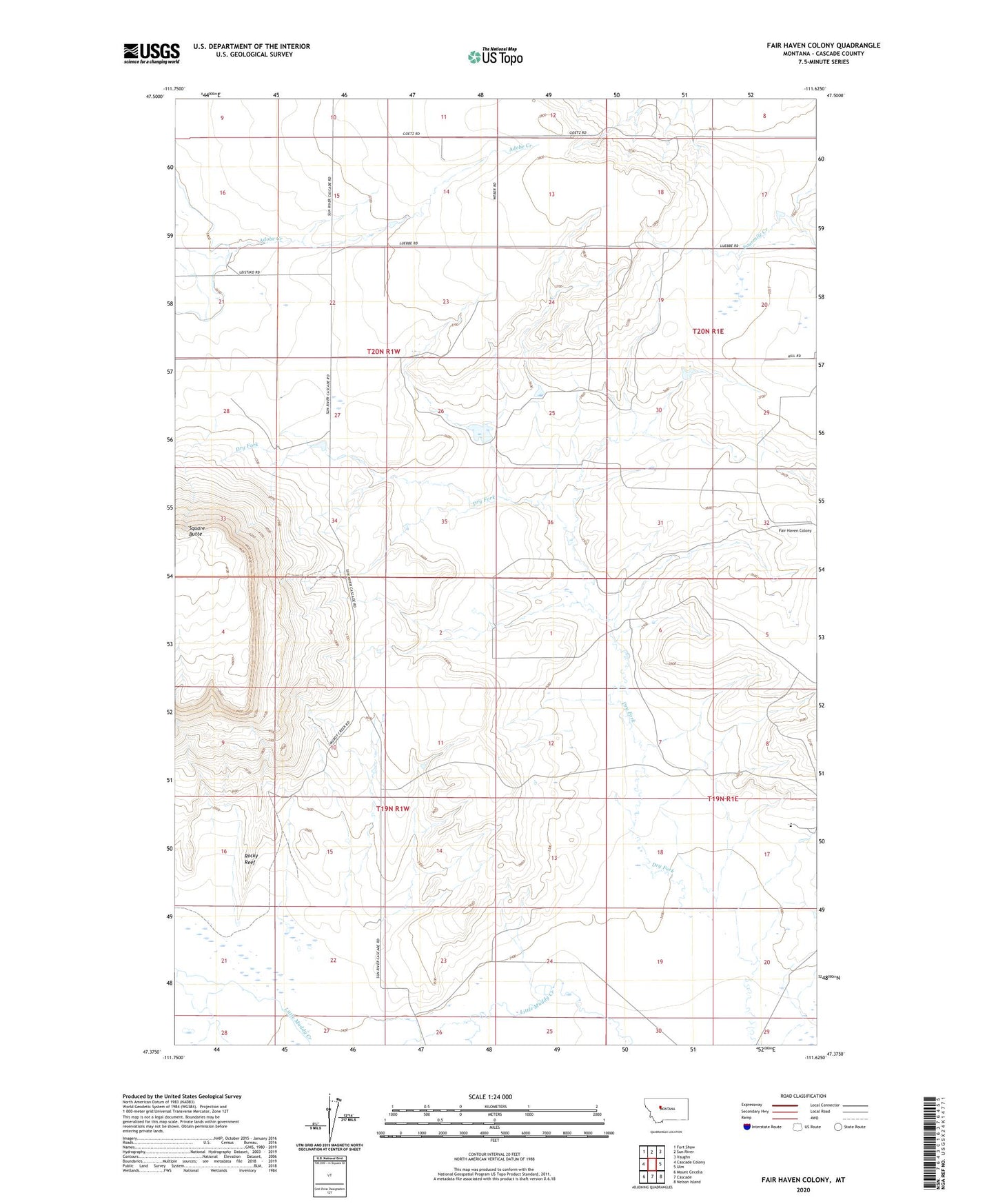
2024 topographic map quadrangle Fair Haven Colony in the state of Montana. Scale: 1:24000. Based on the newly updated USGS 7.5' US Topo map series, this map is in the following counties: Cascade. The map contains contour data, water features, and other items you are used to seeing on USGS maps, but also has updated roads and other features. This is the next generation of topographic maps. Printed on high-quality waterproof paper with UV fade-resistant inks.
Quads adjacent to this one:
West: Cascade Colony
Northwest: Fort Shaw
North: Sun River
Northeast: Vaughn
East: Ulm
Southeast: Nelson Island
South: Cascade
Southwest: Mount Cecelia
This map covers the same area as the classic USGS quad with code o47111d6.
Contains the following named places: 19N01E05B___01 Spring, 19N01E07D___01 Well, 19N01E17A___01 Well, 19N01W01B___01 Well, 19N01W02A___01 Well, 19N01W12B___01 Well, 19N01W21B___01 Well, 19N01W22A___01 Well, 19N01W22A___02 Well, 20N01W27A___01 Well, 20N01W34B___01 Well, 20N01W35B___01 Well, 59483, Cascade Muddy School, Dry Fork Fairhaven Number 1 Dam, Fair Haven Colony, Fair Haven Colony Census Designated Place, Fairhaven Colony School, Gibbons School, GMG Dam, Square Butte