MyTopo
Vipond Park Montana US Topo Map
Couldn't load pickup availability
Also explore the Vipond Park Forest Service Topo of this same quad for updated USFS data
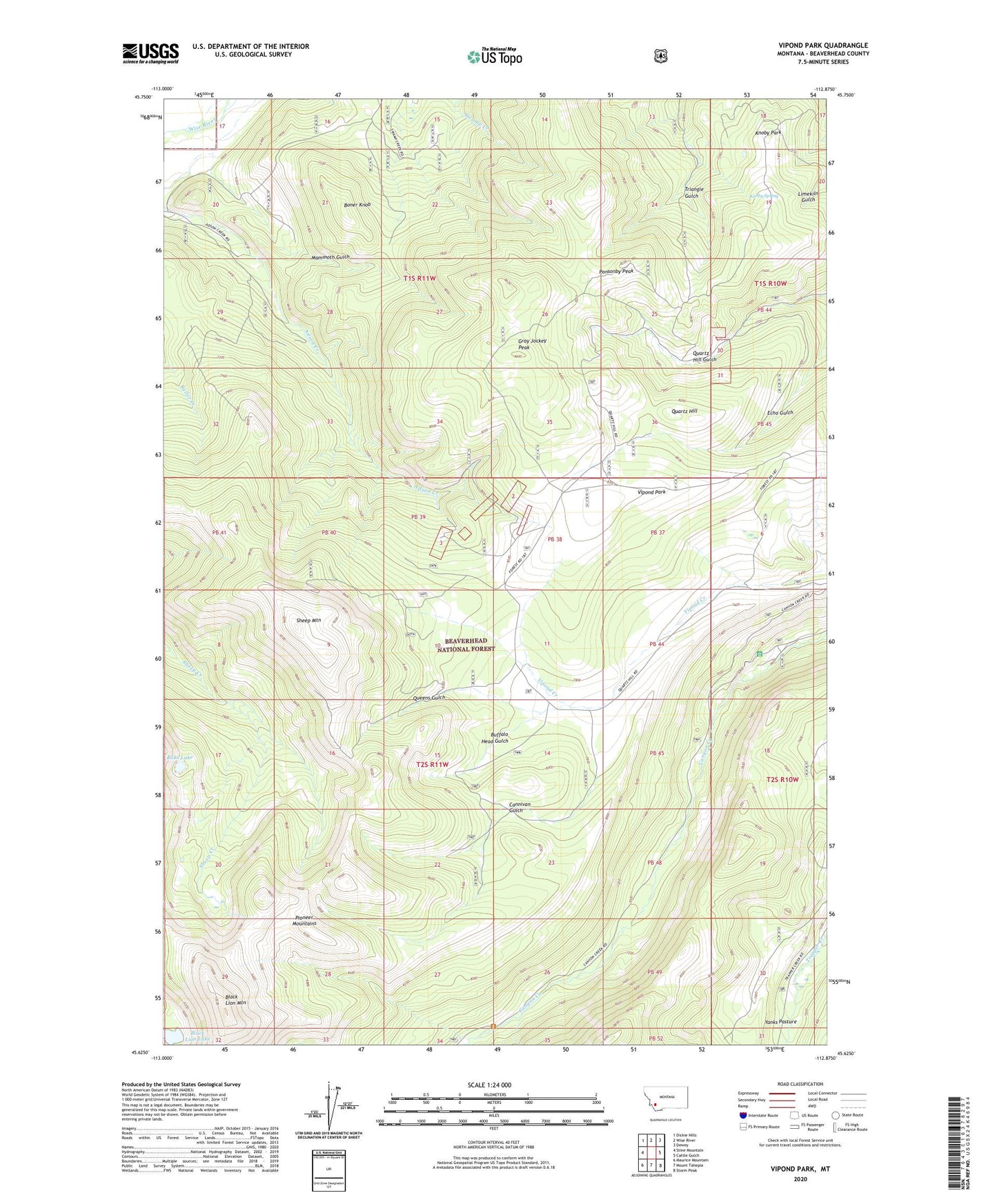
2024 topographic map quadrangle Vipond Park in the state of Montana. Scale: 1:24000. Based on the newly updated USGS 7.5' US Topo map series, this map is in the following counties: Beaverhead. The map contains contour data, water features, and other items you are used to seeing on USGS maps, but also has updated roads and other features. This is the next generation of topographic maps. Printed on high-quality waterproof paper with UV fade-resistant inks.
Quads adjacent to this one:
West: Stine Mountain
Northwest: Dickie Hills
North: Wise River
Northeast: Dewey
East: Cattle Gulch
Southeast: Storm Peak
South: Mount Tahepia
Southwest: Maurice Mountain
This map covers the same area as the classic USGS quad with code o45112f8.
Contains the following named places: Black Lion Lake, Black Lion Mountain, Blue Bell Mine, Bobs Lake, Boner Knob, Buffalo Head Gulch, Burnt Pine Post Office, Cannivan Gulch, Canyon Creek Camp, Canyon Creek Campground, Canyon Creek Guard Station, Daisy Vein Mine, Gray Jockey Mine, Gray Jockey Peak, Great Western Mine, Greenwood, Knoby Mine, Knoby Park, Knoby Spring, Log Cabin Lode, Log Cabin Mine, Lone Pine, Lone Pine Mine, Mammoth Gulch, Marmot Mine, Mewonitoc Mine, Monte Cristo Mine, Old Faithful Mine, Polaris Mine, Ponsonby Peak, Quartz Hill, Queen of the Hills Mine, Queens Gulch, Sheep Mountain, SW NE Section 3 Mine, Tuxedo Mine, Vega Mine, Vipond, Vipond Park, Vipond Post Office, West Lone Pine Mine, Yanks Pasture