MyTopo
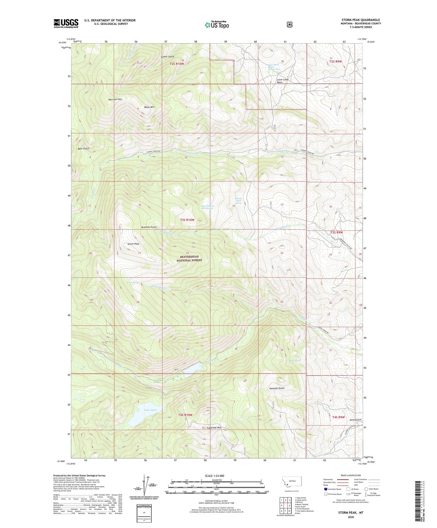
Storm Peak Montana US Topo Map
Couldn't load pickup availability
Also explore the Storm Peak Forest Service Topo of this same quad for updated USFS data
2024 topographic map quadrangle Storm Peak in the state of Montana. Scale: 1:24000. Based on the newly updated USGS 7.5' US Topo map series, this map is in the following counties: Beaverhead. The map contains contour data, water features, and other items you are used to seeing on USGS maps, but also has updated roads and other features. This is the next generation of topographic maps. Printed on high-quality waterproof paper with UV fade-resistant inks.
Quads adjacent to this one:
West: Mount Tahepia
Northwest: Vipond Park
North: Cattle Gulch
Northeast: Melrose
East: Earls Gulch
Southeast: Glen
South: Twin Adams Mountain
Southwest: Torrey Mountain
This map covers the same area as the classic USGS quad with code o45112e7.
Contains the following named places: Agnes Lake Dam, Beals Mountain, Bear Gulch, Brownes Lake, Brownes Lake Dam, Brownes Lake Fishing Access Site, Brownes Lake Recreation Site, Browns Gulch Spring, Dark Hole, Gross Ranch, Ivanhoe Mine, Jacks Gulch, Lake Agnes, Lelow Basin Spring Number Two, Louie Lowe Basin, Morrison Hill, Rock Creek Guard Station, Spritzer Ranch, Storm Park, Storm Park Creek, Storm Peak, Storm Spring, Sugarloaf Mountain, Upper Browns Gulch Spring