MyTopo
Mount Tahepia Montana US Topo Map
Couldn't load pickup availability
Also explore the Mount Tahepia Forest Service Topo of this same quad for updated USFS data
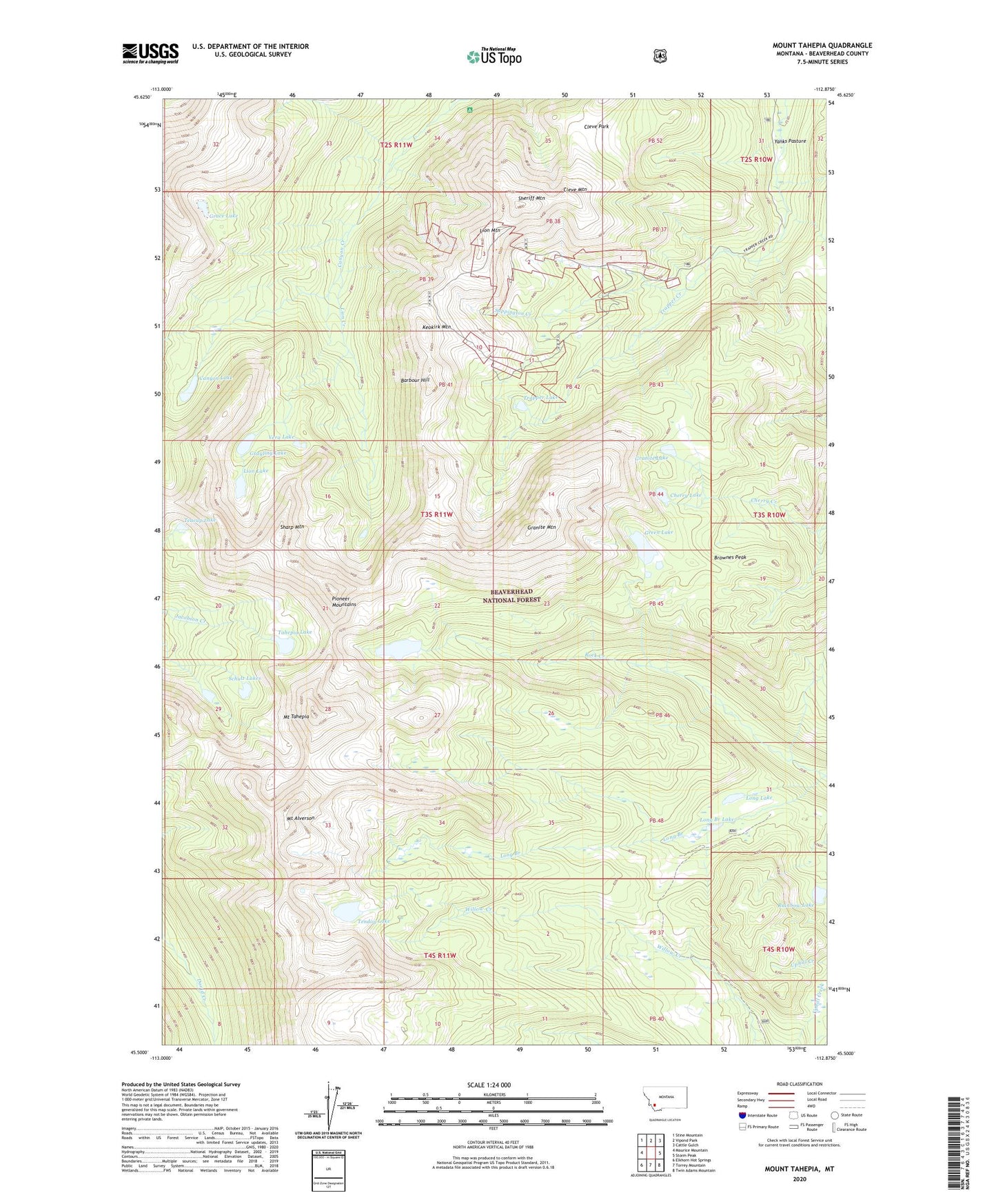
2024 topographic map quadrangle Mount Tahepia in the state of Montana. Scale: 1:24000. Based on the newly updated USGS 7.5' US Topo map series, this map is in the following counties: Beaverhead. The map contains contour data, water features, and other items you are used to seeing on USGS maps, but also has updated roads and other features. This is the next generation of topographic maps. Printed on high-quality waterproof paper with UV fade-resistant inks.
Quads adjacent to this one:
West: Maurice Mountain
Northwest: Stine Mountain
North: Vipond Park
Northeast: Cattle Gulch
East: Storm Peak
Southeast: Twin Adams Mountain
South: Torrey Mountain
Southwest: Elkhorn Hot Springs
This map covers the same area as the classic USGS quad with code o45112e8.
Contains the following named places: Barbour Hill, Brownes Peak, Canyon Creek Guest Ranch, Canyon Creek Recreation Site, Canyon Lake, Cherry Lake, Cleopatra Mine, Cleve Mine, Cleve Mountain, Cleve Park, Elm - Orlu Mine, Franklin Mine, Gold Creek Trail, Grace Lake, Granite Lake, Granite Mountain, Grayling Lake, Green Lake, Hecla, Hecla Mines, Hecla Post Office, Hecla School, Keokirk Mine, Keokirk Mountain, Lion City, Lion Creek, Lion Lake, Lion Mountain, Long Branch, Long Branch Lake, Long Lake, Lower Cleve Mine, Minnie-Gaffney Mine, Mount Alverson, Mount Tahepia, Rainbow Lake, Sappington Creek, Schulz Lakes, SE Section 3 Mine, Sharp Mountain, Sheriff Mountain, Silver King Mine, SW Section 11 Mine, Tahepia Lake, Teacup Lake, Tendoy Lake, Trapper Lake, Trapper Mine, True Blue Mine, Vera Lake, Waukena Lake, Waukena Lake Dam