MyTopo
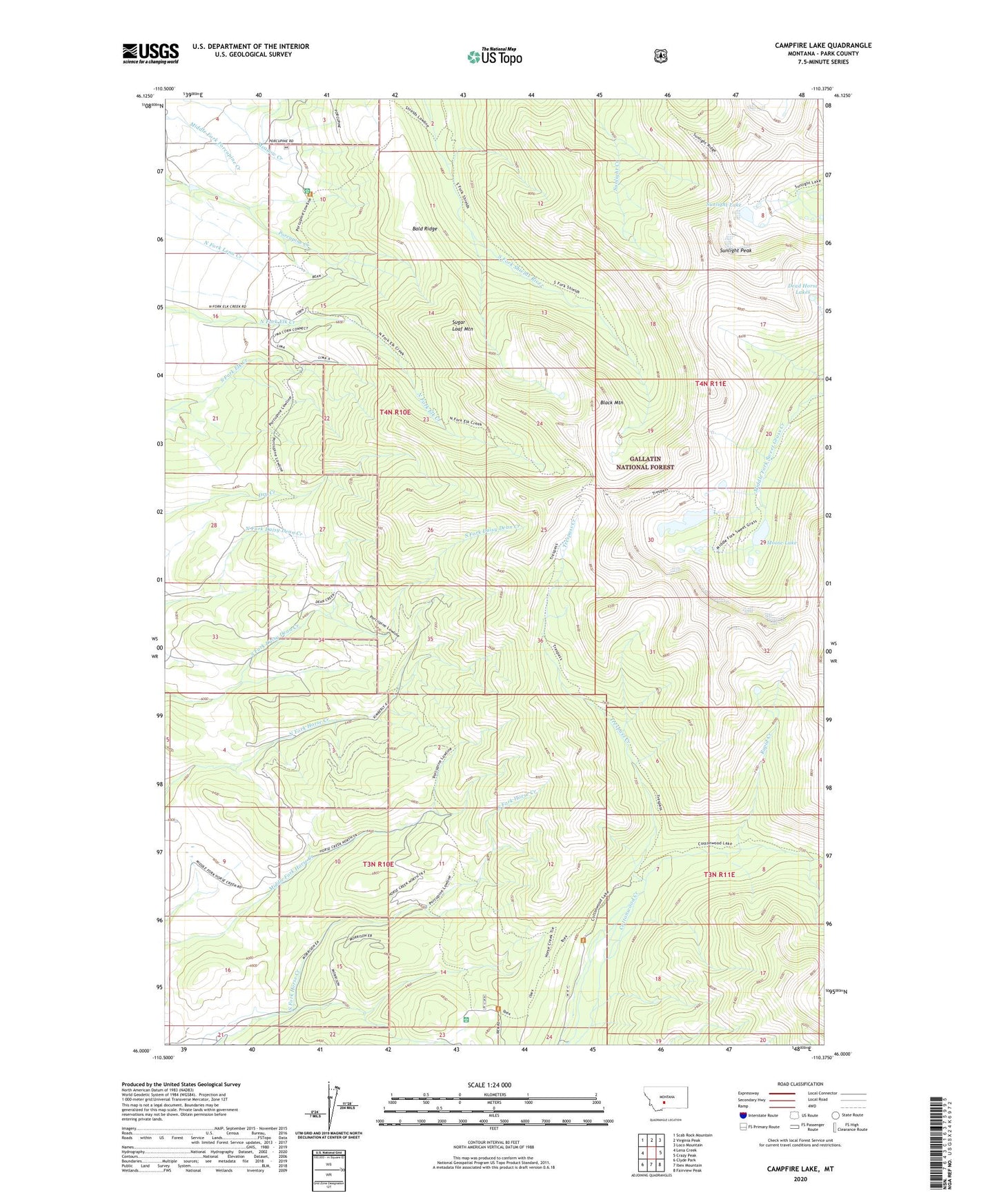
Campfire Lake Montana US Topo Map
Couldn't load pickup availability
Also explore the Campfire Lake Forest Service Topo of this same quad for updated USFS data
2024 topographic map quadrangle Campfire Lake in the state of Montana. Scale: 1:24000. Based on the newly updated USGS 7.5' US Topo map series, this map is in the following counties: Park. The map contains contour data, water features, and other items you are used to seeing on USGS maps, but also has updated roads and other features. This is the next generation of topographic maps. Printed on high-quality waterproof paper with UV fade-resistant inks.
Quads adjacent to this one:
West: Lena Creek
Northwest: Scab Rock Mountain
North: Virginia Peak
Northeast: Loco Mountain
East: Crazy Peak
Southeast: Fairview Peak
South: Ibex Mountain
Southwest: Clyde Park
This map covers the same area as the classic USGS quad with code o46110a4.
Contains the following named places: Bald Ridge, Black Mountain, Campfire Lake, Dead Horse Lakes, Ibex Guard Station, Moose Lake, Porcupine Guard Station, Rapid Creek, Sugar Loaf Mountain, Sunlight Lake, Sunlight Peak, Trespass Creek, Walton Dam