MyTopo
Coburg Montana US Topo Map
Couldn't load pickup availability
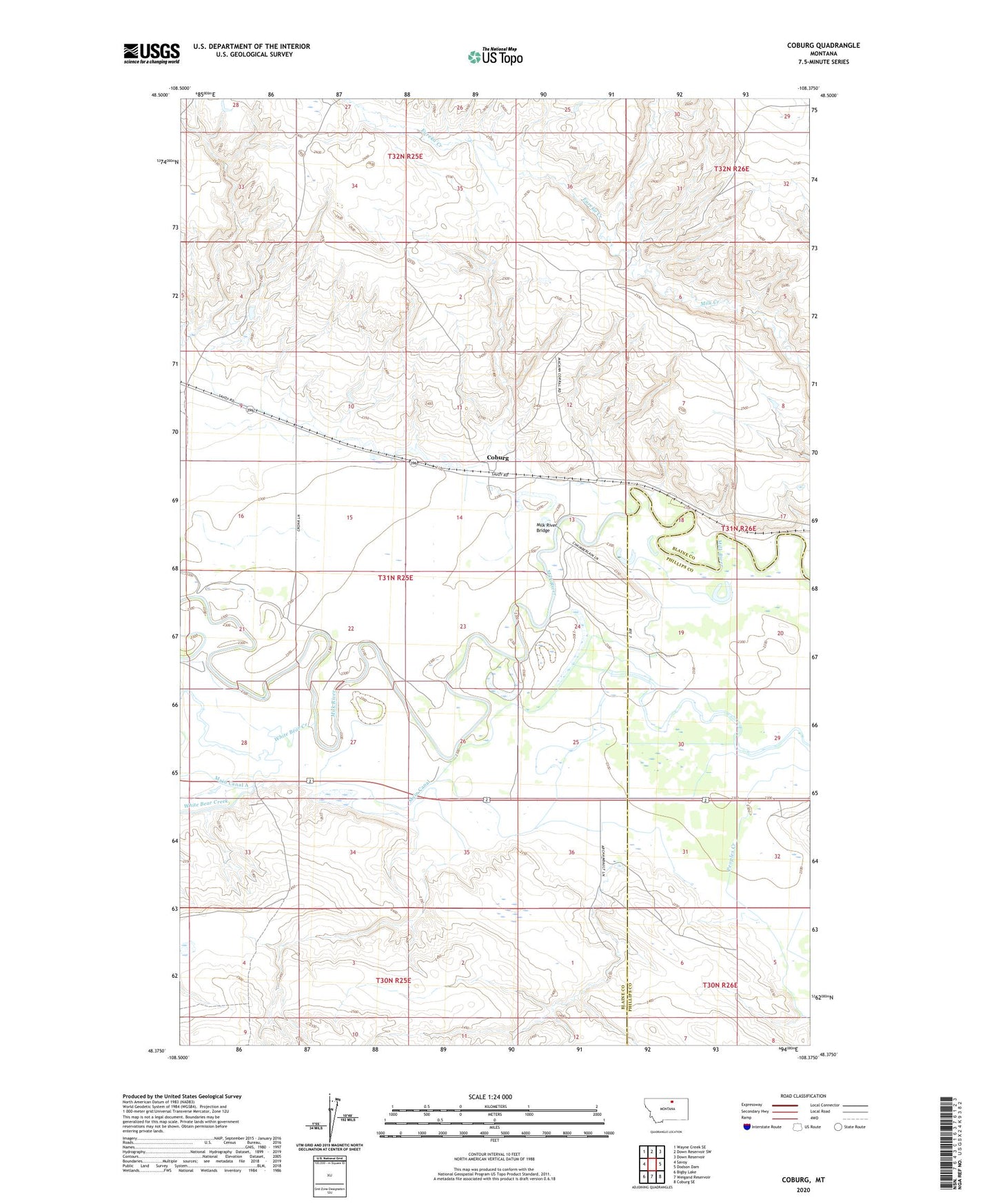
2024 topographic map quadrangle Coburg in the state of Montana. Scale: 1:24000. Based on the newly updated USGS 7.5' US Topo map series, this map is in the following counties: Blaine, Phillips. The map contains contour data, water features, and other items you are used to seeing on USGS maps, but also has updated roads and other features. This is the next generation of topographic maps. Printed on high-quality waterproof paper with UV fade-resistant inks.
Quads adjacent to this one:
West: Savoy
Northwest: Wayne Creek SE
North: Down Reservoir SW
Northeast: Down Reservoir
East: Dodson Dam
Southeast: Coburg SE
South: Weigand Reservoir
Southwest: Bigby Lake
This map covers the same area as the classic USGS quad with code o48108d4.
Contains the following named places: 31N25E21CBCD01 Well, 31N25E24CCAA01 Well, 31N25E24CCB_01 Well, 31N25E24CCB_02 Well, 31N26E19DCCD01 Well, 31N26E32BAD_01 Well, 31N26E32BAD_02 Well, BR-38 Dam, Coburg, Coburg Post Office, Coburg School, Eureka Creek, Main Canal, Mayflower Dam, Milk River Bridge, North Star School, White Bear Creek