MyTopo
Candle Mountain Montana US Topo Map
Couldn't load pickup availability
Also explore the Candle Mountain Forest Service Topo of this same quad for updated USFS data
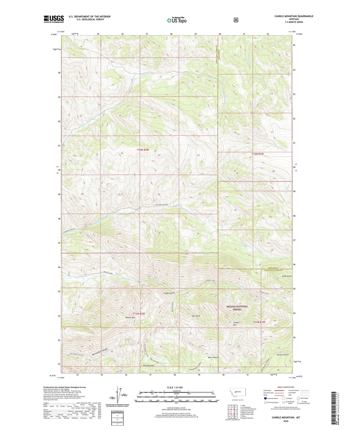
2024 topographic map quadrangle Candle Mountain in the state of Montana. Scale: 1:24000. Based on the newly updated USGS 7.5' US Topo map series, this map is in the following counties: Lewis and Clark, Cascade. The map contains contour data, water features, and other items you are used to seeing on USGS maps, but also has updated roads and other features. This is the next generation of topographic maps. Printed on high-quality waterproof paper with UV fade-resistant inks.
Quads adjacent to this one:
West: Beartooth Mountain
Northwest: Craig
North: The Sawteeth
Northeast: Hound Creek Reservoir
East: Middle Creek Lake
Southeast: Hogback Mountain
South: Nelson
Southwest: Upper Holter Lake
This map covers the same area as the classic USGS quad with code o46111h7.
Contains the following named places: Bear Prairie, Beartooth Game Management Area, Camp Gulch, Candle Gulch, Candle Mountain, Kennedy Spring, Old Ives Place, Slip Gulch, Willow Mountain