MyTopo
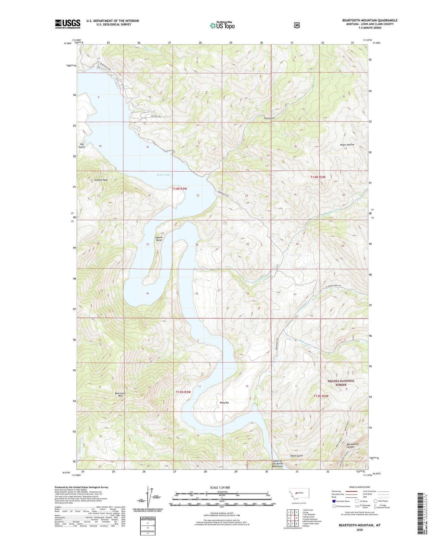
Beartooth Mountain Montana US Topo Map
Couldn't load pickup availability
Also explore the Beartooth Mountain Forest Service Topo of this same quad for updated USFS data
2024 topographic map quadrangle Beartooth Mountain in the state of Montana. Scale: 1:24000. Based on the newly updated USGS 7.5' US Topo map series, this map is in the following counties: Lewis and Clark. The map contains contour data, water features, and other items you are used to seeing on USGS maps, but also has updated roads and other features. This is the next generation of topographic maps. Printed on high-quality waterproof paper with UV fade-resistant inks.
Quads adjacent to this one:
West: Sheep Creek
Northwest: Wolf Creek
North: Craig
Northeast: The Sawteeth
East: Candle Mountain
Southeast: Nelson
South: Upper Holter Lake
Southwest: Rattlesnake Mountain
This map covers the same area as the classic USGS quad with code o46111h8.
Contains the following named places: Beartooth Mountain, Beartooth Ranch, Burke Creek, Cottonwood Creek, Dennison, Departure Point Campground, Elkhorn Creek, Falls Gulch, Gates of the Rocky Mountains, Holter Lake, Holter Lake Campground, Holter Lake State Recreation Area, Indian Trail Lodge, Jackson Peak, Juniper Campground, Log Gulch, Log Gulch Campground, Log Gulch Recreation Area, Mann Gulch, Mann Gulch Fire Smokejumper Meemorials, Ming Bar, Ming Bar Landing Strip, Oxbow Bend, Sperry Ranch, Willow Creek, Wolf Creek - Craig Fire Service Area Station 3, Wolf Creek Division