MyTopo
Hudiburgh Reservoir Montana US Topo Map
Couldn't load pickup availability
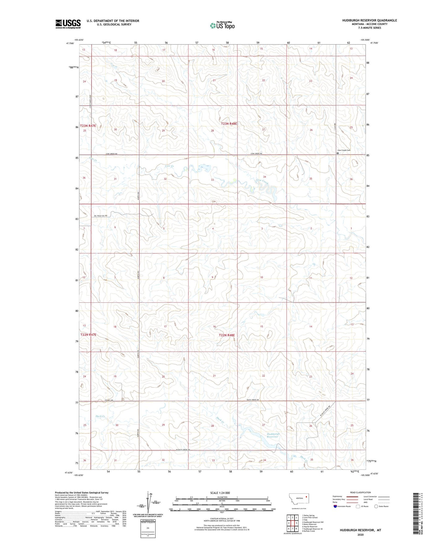
2024 topographic map quadrangle Hudiburgh Reservoir in the state of Montana. Scale: 1:24000. Based on the newly updated USGS 7.5' US Topo map series, this map is in the following counties: McCone. The map contains contour data, water features, and other items you are used to seeing on USGS maps, but also has updated roads and other features. This is the next generation of topographic maps. Printed on high-quality waterproof paper with UV fade-resistant inks.
Quads adjacent to this one:
West: Hudiburgh Reservoir NW
Northwest: Dailey Spring
North: Lone Pine School
Northeast: Vida
East: Beery Reservoir
Southeast: Buffalo Creek
South: Hudiburgh Reservoir SE
Southwest: Haynie Reservoir
This map covers the same area as the classic USGS quad with code o47105f5.
Contains the following named places: 22N48E05CCBB01 Well, 22N48E06ABBC01 Well, 22N48E10DDDB01 Well, 22N48E15BCCA01 Well, 22N48E17DDCA01 Well, 22N48E18BCAD01 Well, 22N48E25BDBC01 Well, 22N48E26CDAA01 Well, 22N48E33BABD01 Well, Cow Creek Cemetery, Hudiburgh Dam, Hudiburgh Reservoir, Vine Reservoir Dam