MyTopo
Dana Ranch Montana US Topo Map
Couldn't load pickup availability
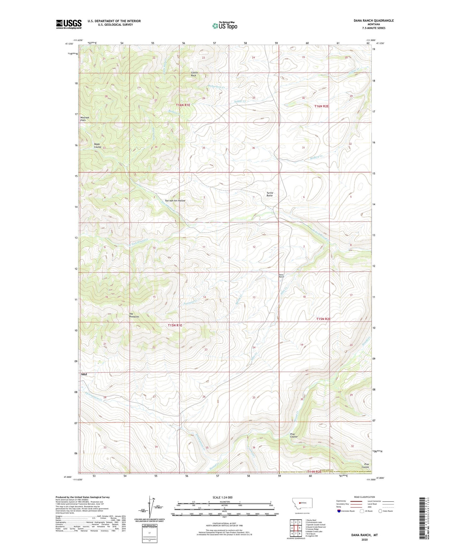
2020 topographic map quadrangle Dana Ranch in the state of Montana. Scale: 1:24000. Based on the newly updated USGS 7.5' US Topo map series, this map is in the following counties: Cascade, Meagher. The map contains contour data, water features, and other items you are used to seeing on USGS maps, but also has updated roads and other features. This is the next generation of topographic maps. Printed on high-quality waterproof paper with UV fade-resistant inks.
Quads adjacent to this one:
West: Hound Creek Reservoir
Northwest: Rocky Reef
North: Schrammeck Lake
Northeast: Spanish Coulee School
East: Conway Ridge
Southeast: Lingshire NW
South: B K Ranch
Southwest: Middle Creek Lake
Contains the following named places: Adel, Adel Post Office, Allen Creek, Castle Rock, Crooked Creek, Dana Ranch, Encampment Creek, Fourteen Creek, Gordon Ranch, Mill Coulee, Parsons Ranch, Pine Coulee, Richardson Creek, Soldier Creek School, Spring Creek, Staunton Ranch, Thompson Ranch, Too-nah-hin Creek, Too-nah-hin Hollow, Turtle Butte, Wade Coulee, Wosinek Flats