MyTopo
Garden Point Montana US Topo Map
Couldn't load pickup availability
Also explore the Garden Point Forest Service Topo of this same quad for updated USFS data
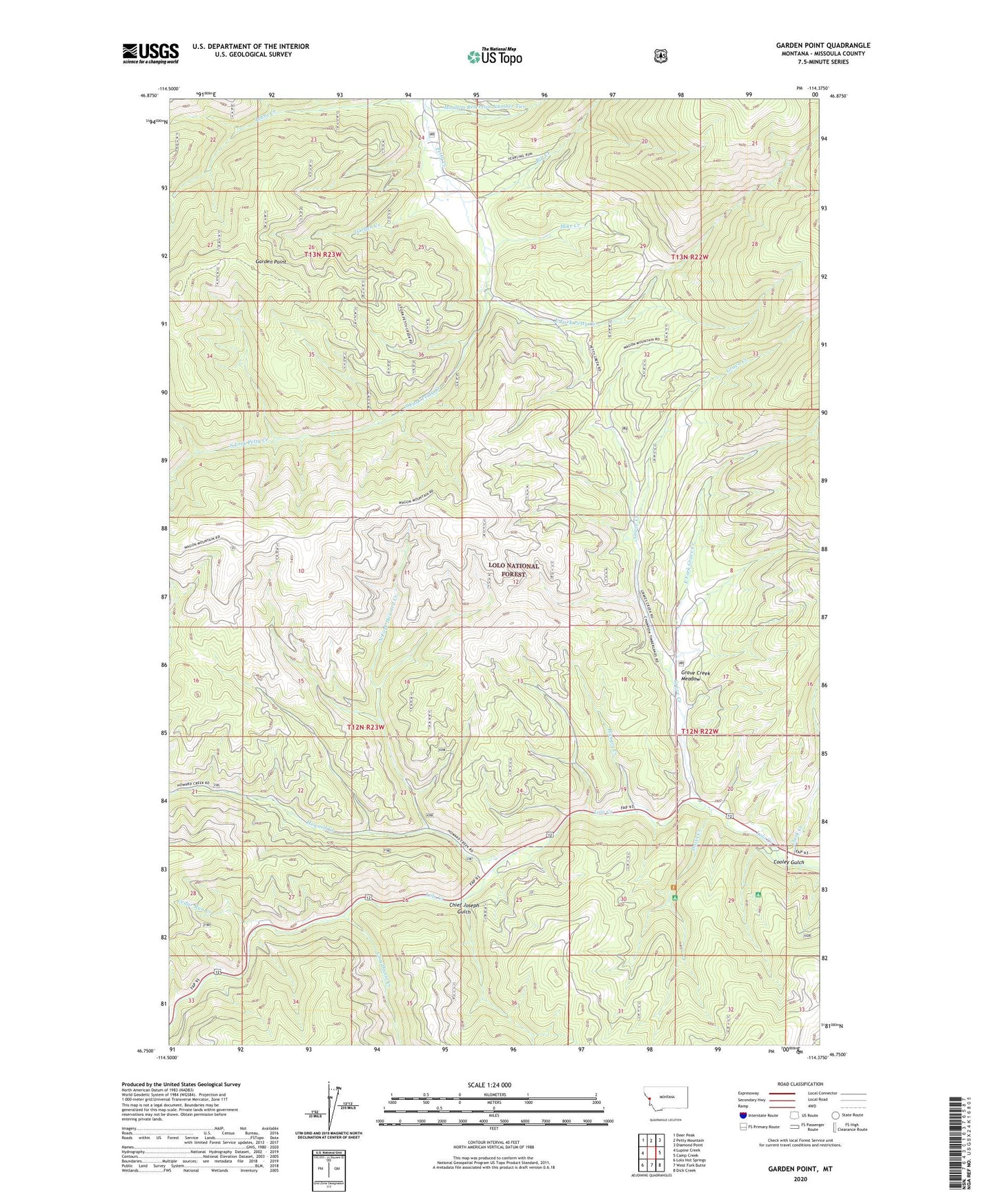
2024 topographic map quadrangle Garden Point in the state of Montana. Scale: 1:24000. Based on the newly updated USGS 7.5' US Topo map series, this map is in the following counties: Missoula. The map contains contour data, water features, and other items you are used to seeing on USGS maps, but also has updated roads and other features. This is the next generation of topographic maps. Printed on high-quality waterproof paper with UV fade-resistant inks.
Quads adjacent to this one:
West: Lupine Creek
Northwest: Deer Peak
North: Petty Mountain
Northeast: Diamond Point
East: Camp Creek
Southeast: Dick Creek
South: West Fork Butte
Southwest: Lolo Hot Springs
This map covers the same area as the classic USGS quad with code o46114g4.
Contains the following named places: Bill Creek, Cedar Run Creek, Chief Joseph Gulch, Clark Creek, Cloudburst Creek, Cooley Gulch, Davis Creek, East Fork Grave Creek, East Fork Petty Creek, Garden Creek, Garden Point, Grave Creek, Grave Creek Meadow, Howard Creek, Hungry Creek, Lewis and Clark Campground, Lolo Ranger Station, Mike Creek, Moulton Reservoir Number Two, North Fork Howard Creek, South Fork Petty Creek