MyTopo
Dixon Montana US Topo Map
Couldn't load pickup availability
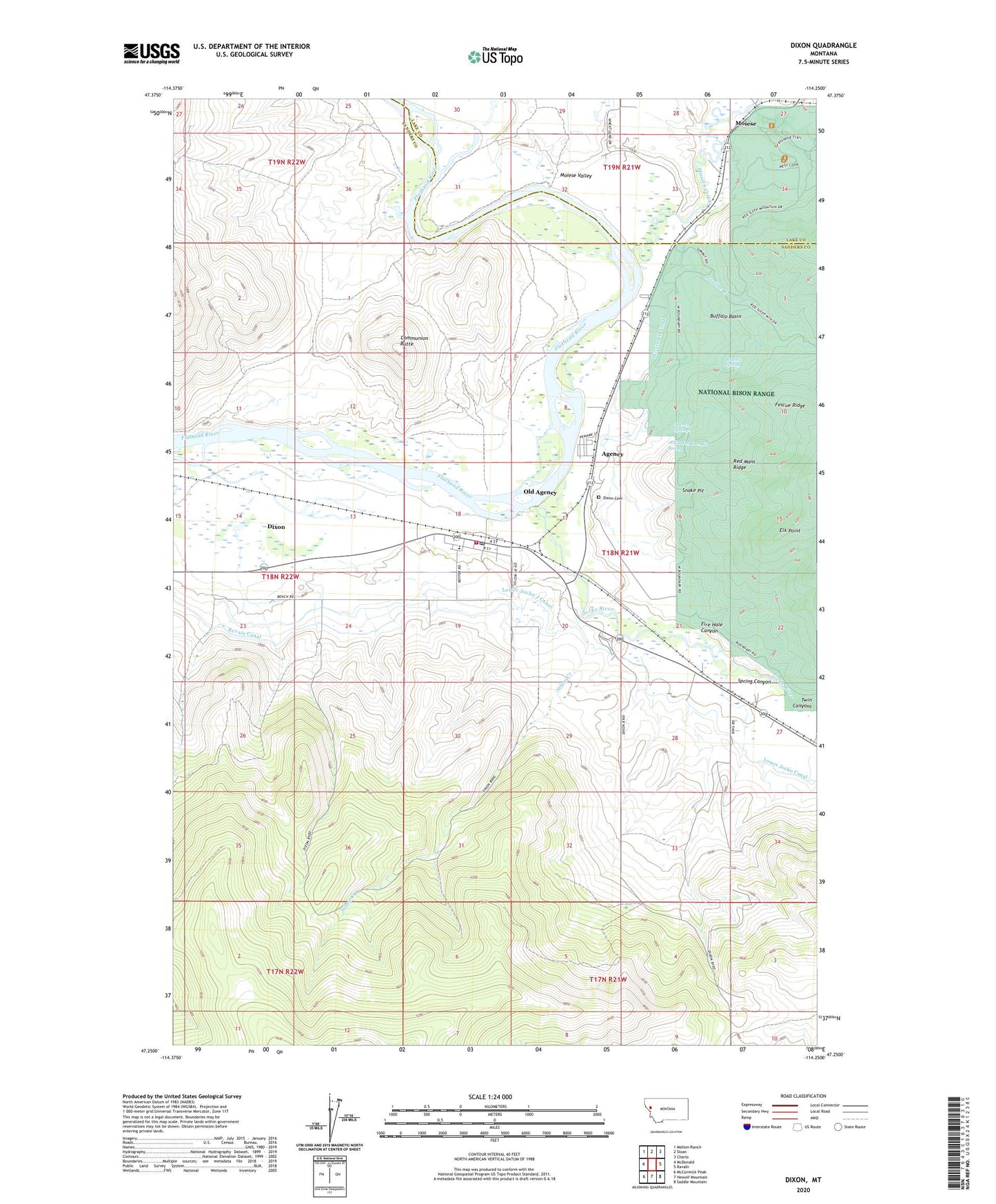
2024 topographic map quadrangle Dixon in the state of Montana. Scale: 1:24000. Based on the newly updated USGS 7.5' US Topo map series, this map is in the following counties: Sanders, Lake. The map contains contour data, water features, and other items you are used to seeing on USGS maps, but also has updated roads and other features. This is the next generation of topographic maps. Printed on high-quality waterproof paper with UV fade-resistant inks.
Quads adjacent to this one:
West: McDonald
Northwest: Melton Ranch
North: Sloan
Northeast: Charlo
East: Ravalli
Southeast: Saddle Mountain
South: Hewolf Mountain
Southwest: McCormick Peak
This map covers the same area as the classic USGS quad with code o47114c3.
Contains the following named places: 18N21W04BCDA01 Well, 18N21W05ADCB01 Well, 18N21W08DDB_01 Well, 18N21W09CDA_01 Spring, 18N21W21BCBB01 Well, 19N21W27CCD_02 Well, 19N21W28CCA_01 Well, 19N21W31ADC_01 Well, 19N21W31DAB_01 Well, 59831, Agency, Agency Springs, Buffalo Basin, Buffalo Spring, Communion Butte, Cortway, Dixon, Dixon Cemetery, Dixon Census Designated Place, Dixon District, Dixon Indian Chapel, Dixon Post Office, Dixon Public School, Dixon Rural Fire Department, Elk Point, Fescue Ridge, Fire Hole Canyon, Jocko River, Lower Jocko J Canal, Mission Creek, Mission H Canal, Moiese, Moiese Post Office, Moiese Valley, Old Agency, Old Agency Census Designated Place, Pauline Creek, Prune Post Office, Revais Canal, Saint Leonards Church, Selow Creek, Snake Pit, Spring Canyon, Twin Canyons