MyTopo
Ravalli Montana US Topo Map
Couldn't load pickup availability
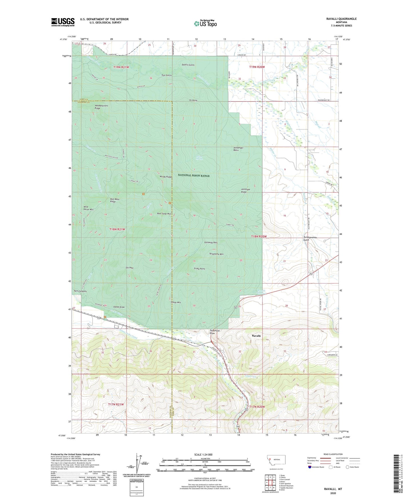
2024 topographic map quadrangle Ravalli in the state of Montana. Scale: 1:24000. Based on the newly updated USGS 7.5' US Topo map series, this map is in the following counties: Lake, Sanders. The map contains contour data, water features, and other items you are used to seeing on USGS maps, but also has updated roads and other features. This is the next generation of topographic maps. Printed on high-quality waterproof paper with UV fade-resistant inks.
Quads adjacent to this one:
West: Dixon
Northwest: Sloan
North: Charlo
Northeast: Fort Connah
East: Saint Ignatius
Southeast: Arlee
South: Saddle Mountain
Southwest: Hewolf Mountain
This map covers the same area as the classic USGS quad with code o47114c2.
Contains the following named places: 17N20W05BBAA01 Well, 17N20W05DBAD01 Well, 18N20W03BAAB01 Well, 18N20W04AABB01 Well, 18N20W07BDA_01 Well, 18N20W16ABBB01 Well, 18N20W32BCC_01 Well, 18N20W32CBDA01 Well, 18N21W01BAD_01 Well, 18N21W11DAA_01 Well, 18N21W26DDCA01 Well, 19N20W33BBC_01 Well, 19N20W34BDA_01 Well, 19N21W25DDDD01 Well, 19N21W34AAB_01 Well, 59863, Alexander Basin, Antelope Ridge, Bison Range Headquarters, Copper Creek, Dublin Gulch, Elk Creek, Elk Pass, Flathead Reservation Historical Marker, Getaway Pass, Gut Gulch, Headquarters Ridge, Indian Springs, Lower Jocko Canal, Matt Creek, Mission Valley Historical Marker, National Bison Range, Pistol Creek, Post Creek, Ravalli, Ravalli Census Designated Place, Ravalli Post Office, Ravalli Potholes, Ravalli Store and Days Rest Campground, Red Mans Ridge, Red Sleep Mountain, Sabine Creek, Sheep Draw, Sheep Mountain, South Fork Pauline Creek, Telephone Draw, Telephone Mountain, Trisky Creek, Trisky Point, Turkeywoman Gulch, TV Point, Wild Horse Mountain, Windy Ridge