MyTopo
Saddle Mountain Montana US Topo Map
Couldn't load pickup availability
Also explore the Saddle Mountain Forest Service Topo of this same quad for updated USFS data
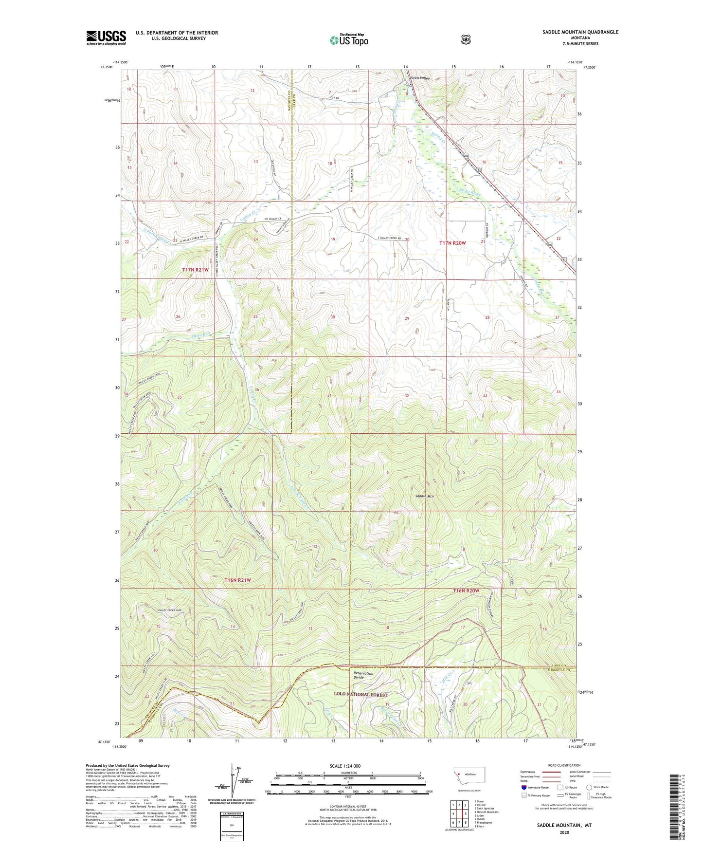
2024 topographic map quadrangle Saddle Mountain in the state of Montana. Scale: 1:24000. Based on the newly updated USGS 7.5' US Topo map series, this map is in the following counties: Lake, Sanders, Missoula. The map contains contour data, water features, and other items you are used to seeing on USGS maps, but also has updated roads and other features. This is the next generation of topographic maps. Printed on high-quality waterproof paper with UV fade-resistant inks.
Quads adjacent to this one:
West: Hewolf Mountain
Northwest: Dixon
North: Ravalli
Northeast: Saint Ignatius
East: Arlee
Southeast: Evaro
South: Frenchtown
Southwest: Huson
This map covers the same area as the classic USGS quad with code o47114b2.
Contains the following named places: 16N19W16ABAB01 Well, 17N20W16CBAA01 Well, 17N20W18CCDA01 Well, 17N20W18DBCD01 Well, 17N20W19ACB_01 Well, 17N20W20ADAA01 Well, 17N20W20BCD_01 Well, 17N20W20CAB_01 Well, 17N20W20CAB_02 Well, 17N20W21ABA_01 Well, 17N20W21BAB_01 Well, 17N20W21BDA_01 Well, 17N20W29ACB_01 Well, East Fork Valley Creek, Flathead, Hewolf Creek, Jocko Valley, Marlowe Springs Fishing Access Site, Nielson Ranch, North Fork Valley Creek, Saddle Mountain, Spring Creek, Valley Creek