MyTopo
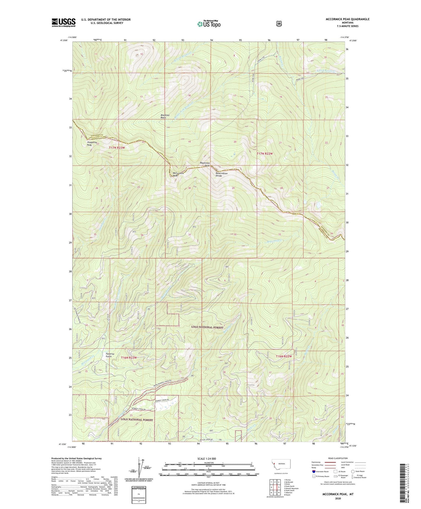
McCormick Peak Montana US Topo Map
Couldn't load pickup availability
Also explore the McCormick Peak Forest Service Topo of this same quad for updated USFS data
2024 topographic map quadrangle McCormick Peak in the state of Montana. Scale: 1:24000. Based on the newly updated USGS 7.5' US Topo map series, this map is in the following counties: Missoula, Sanders. The map contains contour data, water features, and other items you are used to seeing on USGS maps, but also has updated roads and other features. This is the next generation of topographic maps. Printed on high-quality waterproof paper with UV fade-resistant inks.
Quads adjacent to this one:
West: Stark North
Northwest: Perma
North: McDonald
Northeast: Dixon
East: Hewolf Mountain
Southeast: Huson
South: Alberton
Southwest: Stark South
This map covers the same area as the classic USGS quad with code o47114b4.
Contains the following named places: Blackrock Peak, Blacktail Basin, East Fork Revais Creek, Favorite Gulch, Hautilla Mine, Josephine Peak, Josephine Trailhead Mine, Kennedy Creek Placer I Mine, Kennedy Creek Placer II Mine, Kennedy Creek Placer III Mine, Kennedy Creek Trail, Little McCormick Creek, Lolo National Forest, Lost Cabin Mine, McCormick Creek Trail, McCormick Peak, Middle Fork Revais Creek, Nugget Mine, Revais Creek Trail, Shining Peak Trail, Upper Lost Cabin Mine