MyTopo
Dorothy Draw Montana US Topo Map
Couldn't load pickup availability
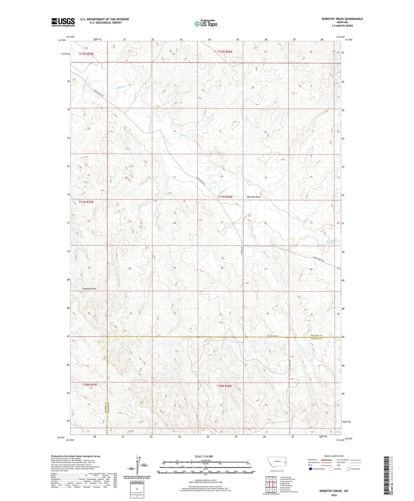
2024 topographic map quadrangle Dorothy Draw in the state of Montana. Scale: 1:24000. Based on the newly updated USGS 7.5' US Topo map series, this map is in the following counties: Prairie, Fallon. The map contains contour data, water features, and other items you are used to seeing on USGS maps, but also has updated roads and other features. This is the next generation of topographic maps. Printed on high-quality waterproof paper with UV fade-resistant inks.
Quads adjacent to this one:
West: Mildred NE
Northwest: Simons Butte
North: Graveyard Hill SW
Northeast: Graveyard Hill
East: Ayer Spring NE
Southeast: Lawrence Creek West
South: Ayer Spring
Southwest: Ismay North
This map covers the same area as the classic USGS quad with code o46104f6.
Contains the following named places: 10N56E04AAAC01 Well, 11N55E12AC__01 Well, 11N55E24AB__01 Well, 11N56E02CA__01 Well, 11N56E02DD__01 Well, 11N56E04ABDB01 Well, 11N56E04BA__01 Well, 11N56E06DB__01 Well, 11N56E06DB__02 Well, 11N56E07AADA01 Well, 11N56E16BC__01 Well, 11N56E19AD__01 Well, 11N56E20AA__01 Well, 11N56E20BCCD01 Well, 11N56E26BB__01 Well, 11N56E34AD__01 Well, 12N55E36DD__01 Well, 12N56E34DAAC01 Well, Cabin Dam, Deer Creek, Dorothy Draw, Fairville School, G G Strobel School, McNaney Creek, Rattlesnake Dam