MyTopo
Ayer Spring NE Montana US Topo Map
Couldn't load pickup availability
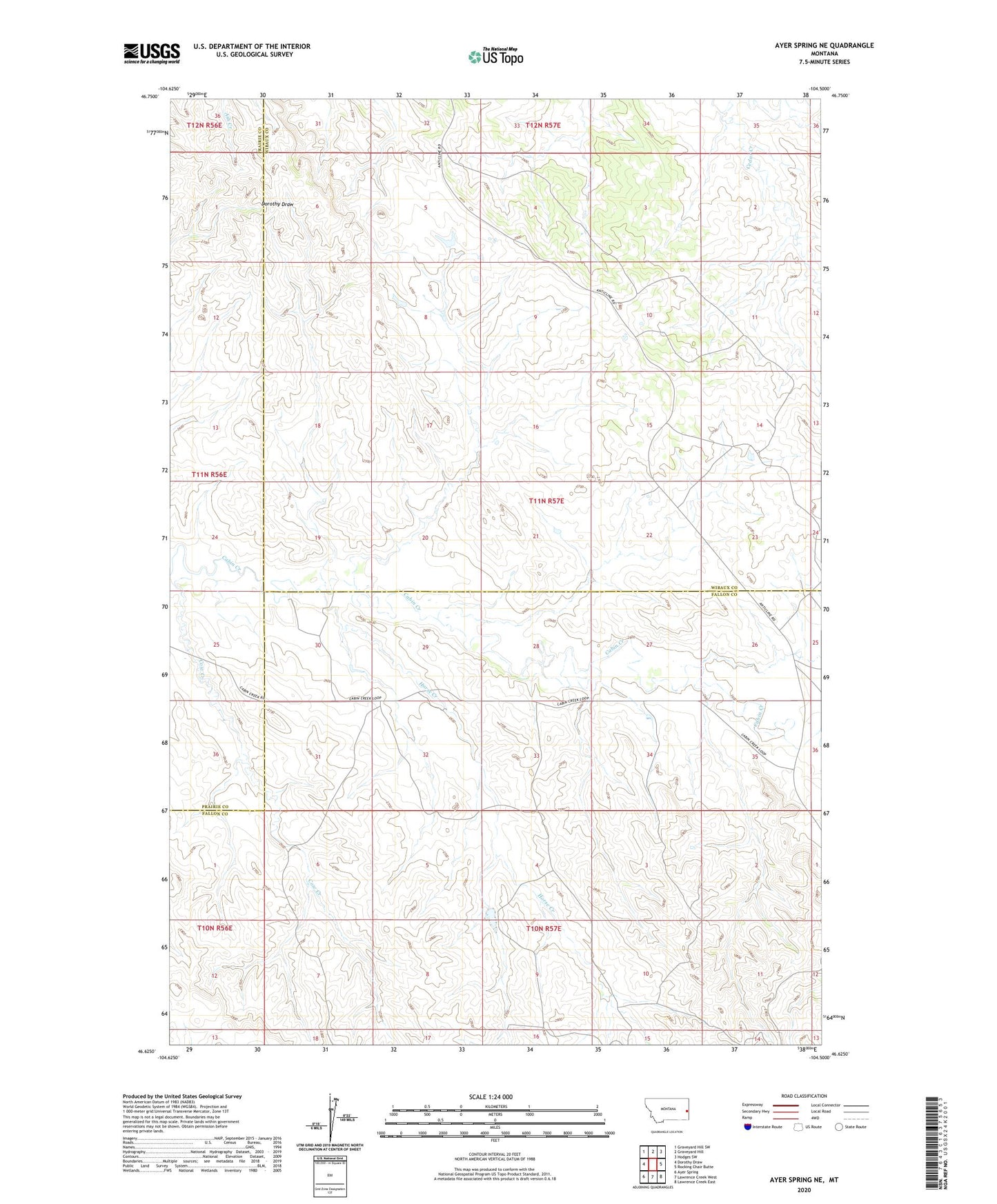
2024 topographic map quadrangle Ayer Spring NE in the state of Montana. Scale: 1:24000. Based on the newly updated USGS 7.5' US Topo map series, this map is in the following counties: Fallon, Wibaux, Prairie. The map contains contour data, water features, and other items you are used to seeing on USGS maps, but also has updated roads and other features. This is the next generation of topographic maps. Printed on high-quality waterproof paper with UV fade-resistant inks.
Quads adjacent to this one:
West: Dorothy Draw
Northwest: Graveyard Hill SW
North: Graveyard Hill
Northeast: Hodges SW
East: Rocking Chair Butte
Southeast: Lawrence Creek East
South: Lawrence Creek West
Southwest: Ayer Spring
This map covers the same area as the classic USGS quad with code o46104f5.
Contains the following named places: 10N57E02CBCB01 Well, 10N57E03BA__01 Well, 10N57E10CC__01 Well, 10N57E16BA__01 Well, 11N57E06CC__01 Well, 11N57E06DD__01 Well, 11N57E07AB__01 Well, 11N57E07CA__01 Well, 11N57E08AA__01 Well, 11N57E09AC__01 Well, 11N57E17AB__01 Well, 11N57E17AB__02 Well, 11N57E17BC__01 Well, 11N57E21CB__01 Well, 11N57E21CB__02 Well, 11N57E21CDBB01 Well, 11N57E23BA__10 Well, 11N57E27CD__01 Well, 11N57E28CC__01 Well, 11N57E29DC__01 Well, 11N57E32BBBD01 Well, 11N57E32DC__01 Well, Cow Creek, Horse Creek, South Pine Oil Field