MyTopo
Graveyard Hill SW Montana US Topo Map
Couldn't load pickup availability
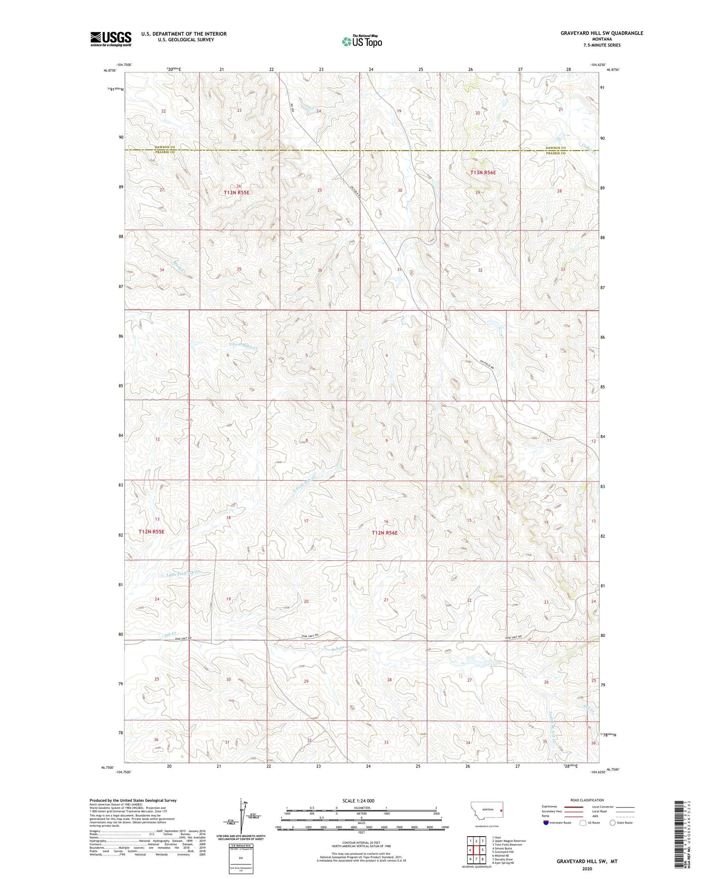
2024 topographic map quadrangle Graveyard Hill SW in the state of Montana. Scale: 1:24000. Based on the newly updated USGS 7.5' US Topo map series, this map is in the following counties: Prairie, Dawson. The map contains contour data, water features, and other items you are used to seeing on USGS maps, but also has updated roads and other features. This is the next generation of topographic maps. Printed on high-quality waterproof paper with UV fade-resistant inks.
Quads adjacent to this one:
West: Simons Butte
Northwest: Hoyt
North: Upper Magpie Reservoir
Northeast: Twin Forks Reservoir
East: Graveyard Hill
Southeast: Ayer Spring NE
South: Dorothy Draw
Southwest: Mildred NE
This map covers the same area as the classic USGS quad with code o46104g6.
Contains the following named places: 10N55E25CDCD01 Well, 12N55E12DB__01 Well, 12N55E13DC__01 Well, 12N55E19CDCD01 Well, 12N55E24CDDD01 Well, 12N55E25CDCC01 Well, 12N55E25DD__01 Well, 12N56E02CC__01 Well, 12N56E10ACDA01 Well, 12N56E18CD__01 Well, 12N56E19CD__01 Well, 12N56E23CCDA01 Well, 12N56E23DCCA01 Well, 12N56E26AB__01 Well, 12N56E26DB__01 Well, 12N56E29AC__01 Well, 12N56E30CD__01 Well, 13N55E22BD__01 Well, 13N55E23ADC_01 Well, 13N55E25DA__01 Well, Ash Creek School, Irion School, Judith Branch Ash Creek, Labelle Ditch, Little Fork Ash Creek