MyTopo
Hope Ranch Montana US Topo Map
Couldn't load pickup availability
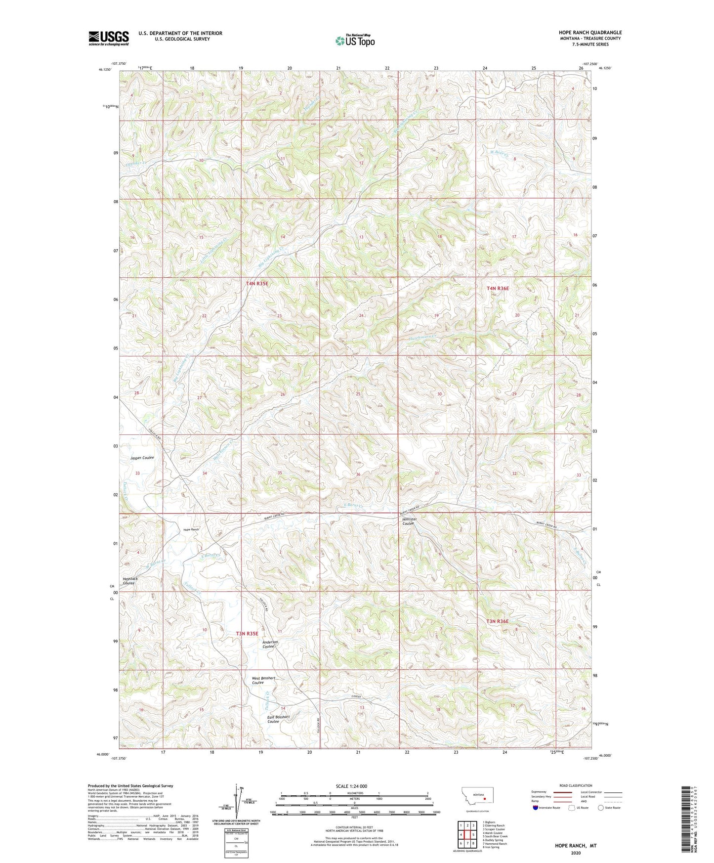
2024 topographic map quadrangle Hope Ranch in the state of Montana. Scale: 1:24000. Based on the newly updated USGS 7.5' US Topo map series, this map is in the following counties: Treasure. The map contains contour data, water features, and other items you are used to seeing on USGS maps, but also has updated roads and other features. This is the next generation of topographic maps. Printed on high-quality waterproof paper with UV fade-resistant inks.
Quads adjacent to this one:
West: Marsh Coulee
Northwest: Bighorn
North: Eldering Ranch
Northeast: Scraper Coulee
East: South Bear Creek
Southeast: Iron Spring
South: Hammond Ranch
Southwest: Dudley Spring
This map covers the same area as the classic USGS quad with code o46107a3.
Contains the following named places: 03N35E01BBAC01 Well, 03N35E11D___01 Well, 03N35E14ACCC01 Well, 04N35E22DBCA01 Well, 04N35E25ABCC01 Well, 04N35E33A___01 Well, 04N36E09DBAA01 Well, Anderson Coulee, Anderson Ranch, Big Lightning Creek, East Bosshart Coulee, East Burnt Creek, Haystack Coulee, Hollister Coulee, Hope et al Number 1 Dam, Hope Ranch, Hutchinson Creek, Jasper Coulee, West Bosshart Coulee, West Burnt Creek