MyTopo
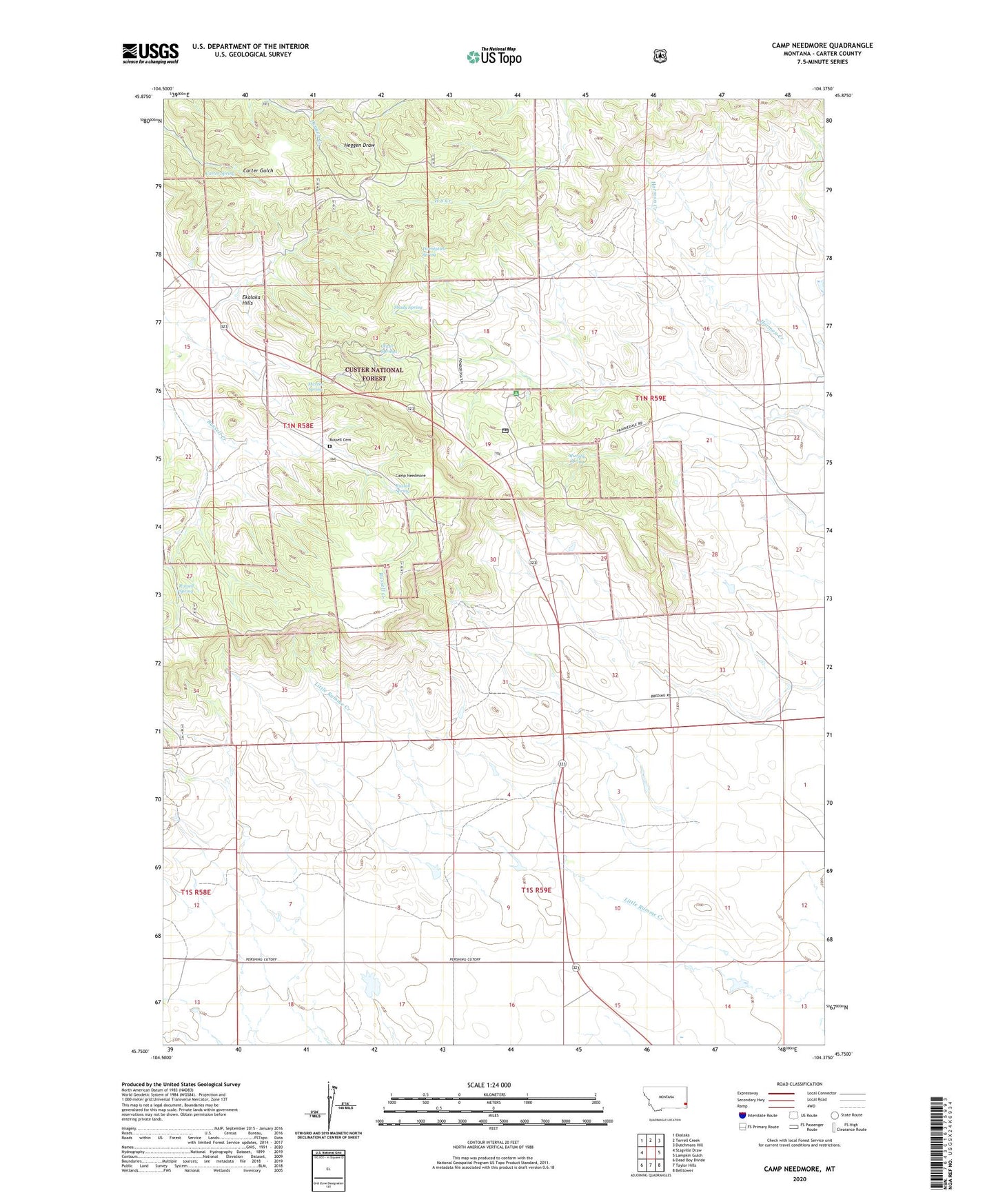
Camp Needmore Montana US Topo Map
Couldn't load pickup availability
Also explore the Camp Needmore Forest Service Topo of this same quad for updated USFS data
2024 topographic map quadrangle Camp Needmore in the state of Montana. Scale: 1:24000. Based on the newly updated USGS 7.5' US Topo map series, this map is in the following counties: Carter. The map contains contour data, water features, and other items you are used to seeing on USGS maps, but also has updated roads and other features. This is the next generation of topographic maps. Printed on high-quality waterproof paper with UV fade-resistant inks.
Quads adjacent to this one:
West: Stagville Draw
Northwest: Ekalaka
North: Terrell Creek
Northeast: Dutchmans Hill
East: Lampkin Gulch
Southeast: Belltower
South: Taylor Hills
Southwest: Dead Boy Divide
This map covers the same area as the classic USGS quad with code o45104g4.
Contains the following named places: 01N58E14BBAA01 Well, 01N58E35CB__01 Well, 01N59E33BDDD01 Well, 01S58E03BCDA01 Well, 01S58E09ABB_01 Well, 01S59E03CC__01 Well, 01S59E06DABA01 Well, Camp Needmore, Carter Spring, Cornigh School, Ekalaka Division, Ekalaka Hills, Elgin, Elgin Post Office, Gundlach Well, Hubbard Number 1 Dam, Macnab Campground, Martin Spring, Murphy Spring, Old CCC Camp, Oliver Springs, Peabody School, Russell Cemetery, Russell Spring, Shady Spring, Twentytwo Spring