MyTopo
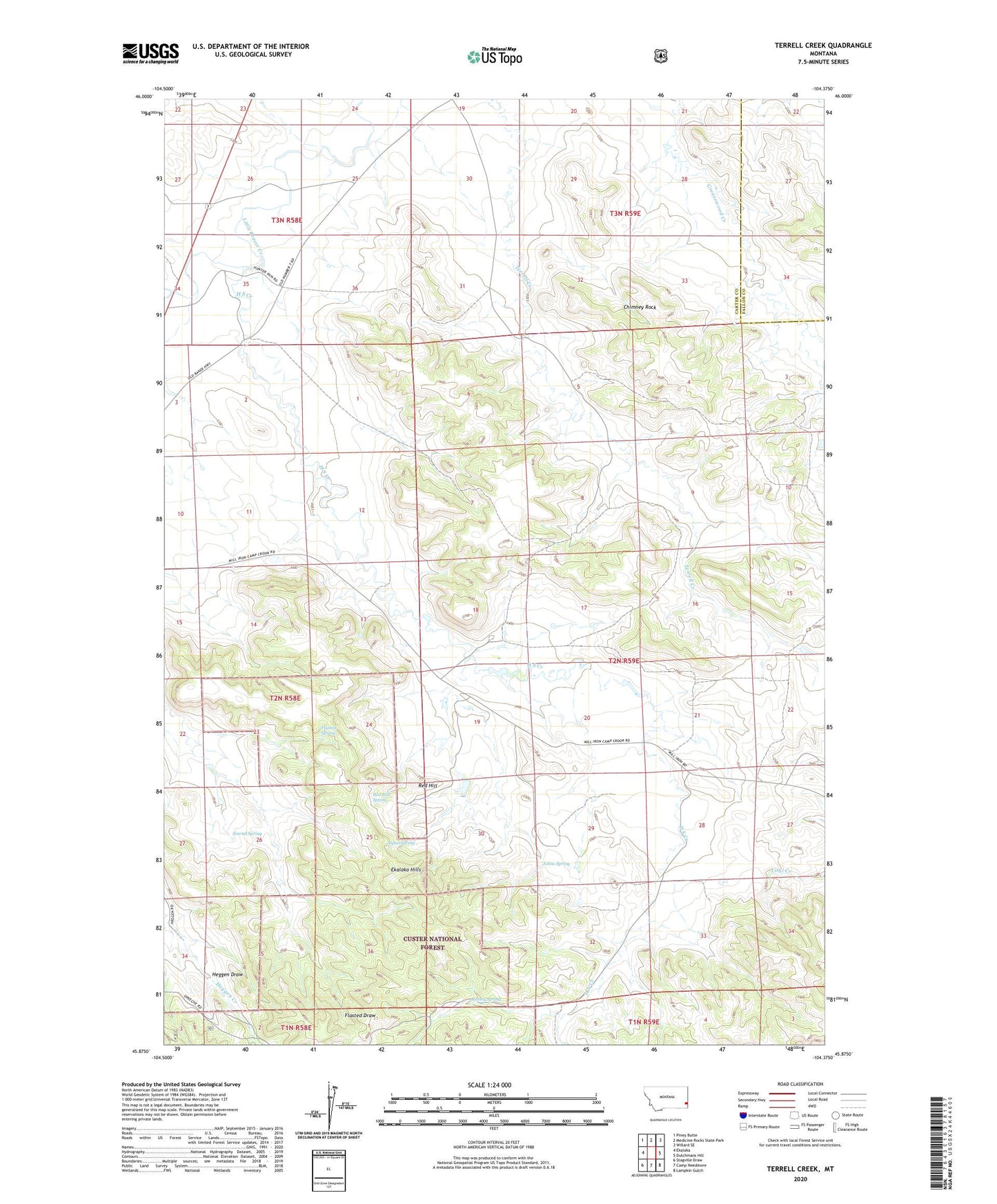
Terrell Creek Montana US Topo Map
Couldn't load pickup availability
Also explore the Terrell Creek Forest Service Topo of this same quad for updated USFS data
2024 topographic map quadrangle Terrell Creek in the state of Montana. Scale: 1:24000. Based on the newly updated USGS 7.5' US Topo map series, this map is in the following counties: Carter, Fallon. The map contains contour data, water features, and other items you are used to seeing on USGS maps, but also has updated roads and other features. This is the next generation of topographic maps. Printed on high-quality waterproof paper with UV fade-resistant inks.
Quads adjacent to this one:
West: Ekalaka
Northwest: Piney Butte
North: Medicine Rocks State Park
Northeast: Willard SE
East: Dutchmans Hill
Southeast: Lampkin Gulch
South: Camp Needmore
Southwest: Stagville Draw
This map covers the same area as the classic USGS quad with code o45104h4.
Contains the following named places: 01N59E05BAC_01 Well, 02N58E20DAA_01 Well, 02N58E20DAD_01 Well, 02N58E32BAD_01 Well, 02N58E32BBD_01 Well, 02N59E19BDBA01 Well, 03N58E33BADD01 Well, Aspen Spring, Chimney Rock, Collins Creek, Flasted Spring, Glenrock Post Office, Glenrock School, H S Creek, Johns Spring, Kinsey Spring, Opechee Park, Opechee Park School, Red Hill, Red Hill Spring, Sinrud Spring, Zelzo Dam