MyTopo
Elk Ridge Montana US Topo Map
Couldn't load pickup availability
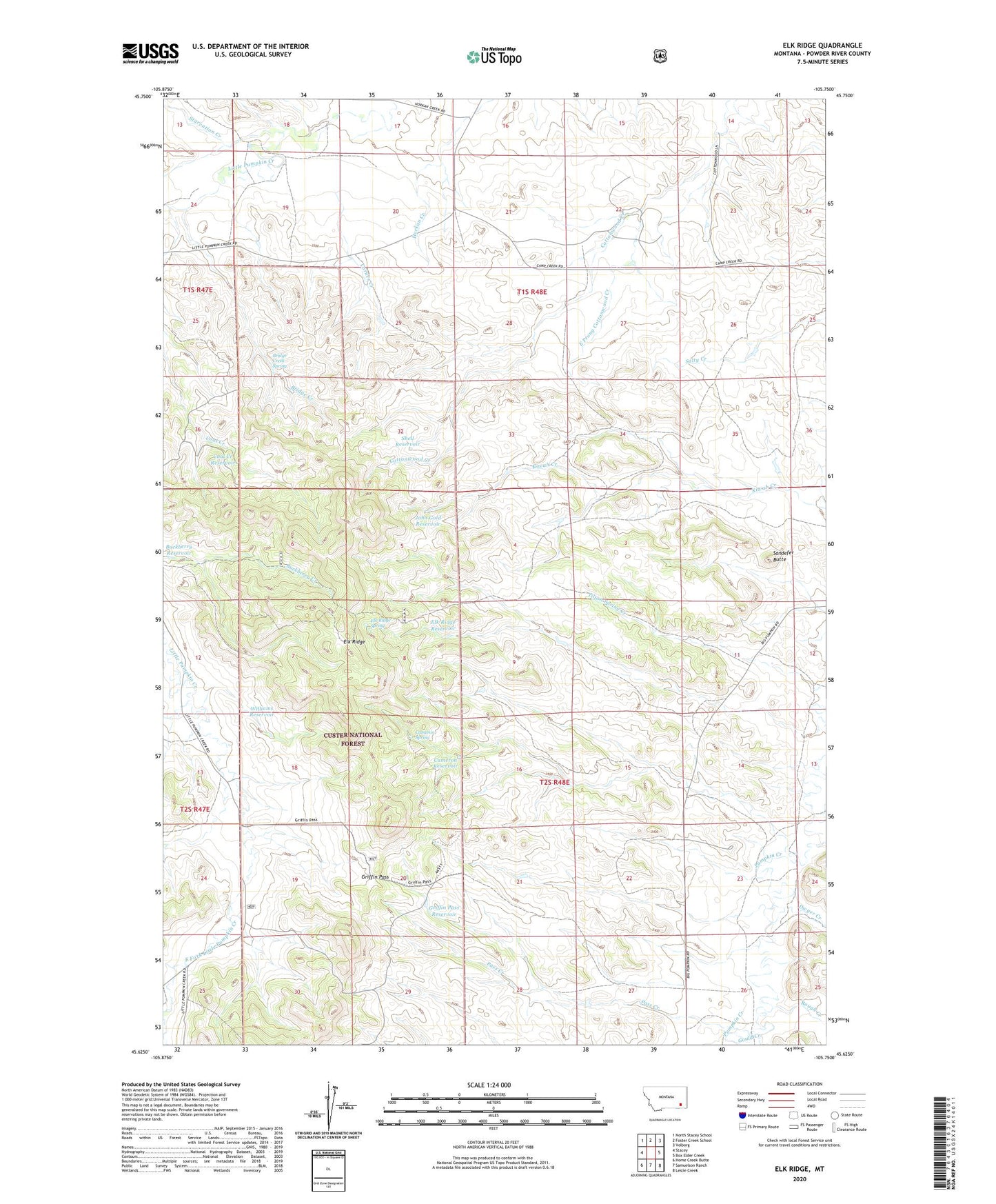
2020 topographic map quadrangle Elk Ridge in the state of Montana. Scale: 1:24000. Based on the newly updated USGS 7.5' US Topo map series, this map is in the following counties: Powder River. The map contains contour data, water features, and other items you are used to seeing on USGS maps, but also has updated roads and other features. This is the next generation of topographic maps. Printed on high-quality waterproof paper with UV fade-resistant inks.
Quads adjacent to this one:
West: Stacey
Northwest: North Stacey School
North: Foster Creek School
Northeast: Volborg
East: Box Elder Creek
Southeast: Leslie Creek
South: Samuelson Ranch
Southwest: Home Creek Butte
Contains the following named places: 01S48E17DDDD01 Well, 02S48E18BCDB01 Well, 02S48E19BCCA01 Well, 02S48E22CAAD01 Well, 02S48E27BDCA01 Well, 02S49E28CBDC01 Well, Bridge Creek, Bridge Creek Spring, Buckberry Reservoir, Cameron Reservoir, Cameron Spring, Coal Creek Reservoir, Corner Creek, Dwyer Creek, East Fork Little Pumpkin Creek, East Prong Cottonwood Creek, Elk Ridge, Elk Ridge Reservoir, Elk Ridge Spring, Gold Well, Gould Creek, Griffin Pass, Griffin Pass Reservoir, Horkan Creek School, John Gold Reservoir, Manning Well, Marvell Creek, Pass Creek, Rough Creek, Sandefer Butte, Shell Reservoir, Starvation Creek, West Fork Little Pumpkin Creek, Williams Reservoir