MyTopo
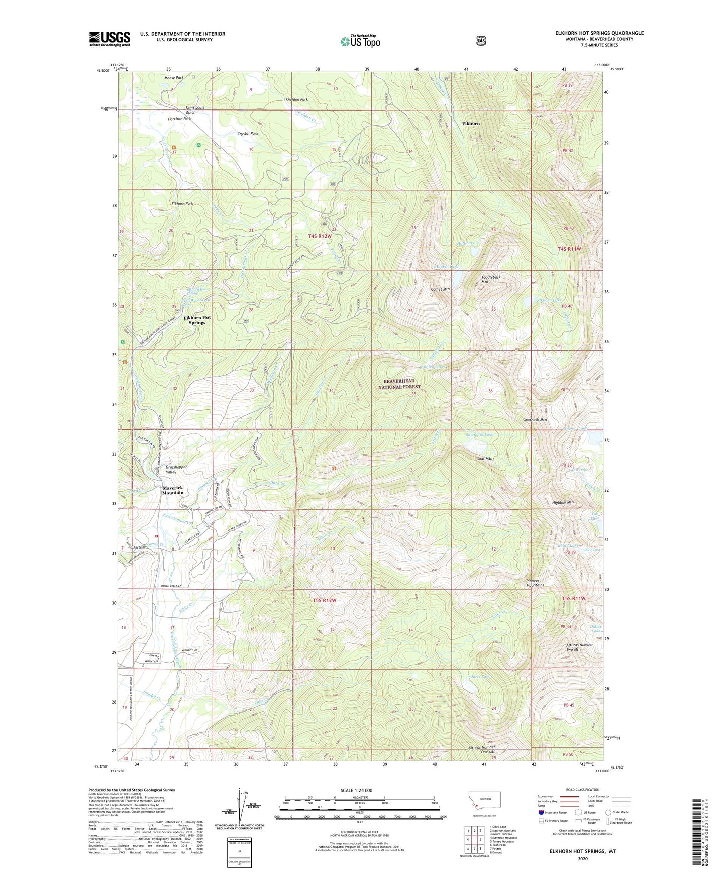
Elkhorn Hot Springs Montana US Topo Map
Couldn't load pickup availability
Also explore the Elkhorn Hot Springs Forest Service Topo of this same quad for updated USFS data
2024 topographic map quadrangle Elkhorn Hot Springs in the state of Montana. Scale: 1:24000. Based on the newly updated USGS 7.5' US Topo map series, this map is in the following counties: Beaverhead. The map contains contour data, water features, and other items you are used to seeing on USGS maps, but also has updated roads and other features. This is the next generation of topographic maps. Printed on high-quality waterproof paper with UV fade-resistant inks.
Quads adjacent to this one:
West: Maverick Mountain
Northwest: Odell Lake
North: Maurice Mountain
Northeast: Mount Tahepia
East: Torrey Mountain
Southeast: Ermont
South: Polaris
Southwest: Tash Peak
This map covers the same area as the classic USGS quad with code o45113d1.
Contains the following named places: 04S12W29ACC_01 Spring, 04S12W29CCCA01 Well, 05S12W08AADC01 Well, 05S12W08CBAA01 Well, 05S12W17CBBA01 Well, 59746, Alturas Number One Mountain, Alturas Number Two Mountain, Anchor Lake, Aspen Mine, Aurora Post Office, Blue Creek, Blue Eyed Annie Mine, Boatman Lake Mine, Chain Lake, Chan Lake, Clark Creek, Comet Mountain, Coolidge, Coolidge Post Office, Coolidge School, Copper Queen Mine, Crystal Park, Crystal Park Picnic Area, Dingley Creek, Dingley Lakes, Dollar Lake, Dory Creek, Driveway Trail, Dutch Park, Elkhorn, Elkhorn Forest Service Station, Elkhorn Hot Springs, Elkhorn Lake, Elkhorn Mill Mine, Elkhorn Ore Mill, Elkhorn Park, Elkhorn School, Elkhorn Upper Camp, Gar Mine, Goat Mountain, Goodenough Park, Grasshopper Campground, Grasshopper Valley Fire Department, Guy Mine, Hall Lake, Harrison Park, Highboy Mountain, Hopkin Lake, Hot Springs Creek, Lake Creek, Lost Cloud Mine, Magna Mine, Maverick Mountain, Maverick Mountain Census Designated Place, Maverick Mountain RV Park, Old Elkhorn Mine, Ore Mill, Park Mine, Polaris Lake, Price Creek, Rhubarb Patch Trail, Saddleback Mountain, Saint Louis Gulch, Sawtooth Lake, Sawtooth Mountain, Shale Creek, Sheldon Park, Shoestring Creek, Snyder Creek, Upper Elkhorn Camp, Upper Elkhorn Mine, Wellman Creek, Wellman Mine, White Creek