
MyTopo
Elm Coulee Montana US Topo Map
Couldn't load pickup availability
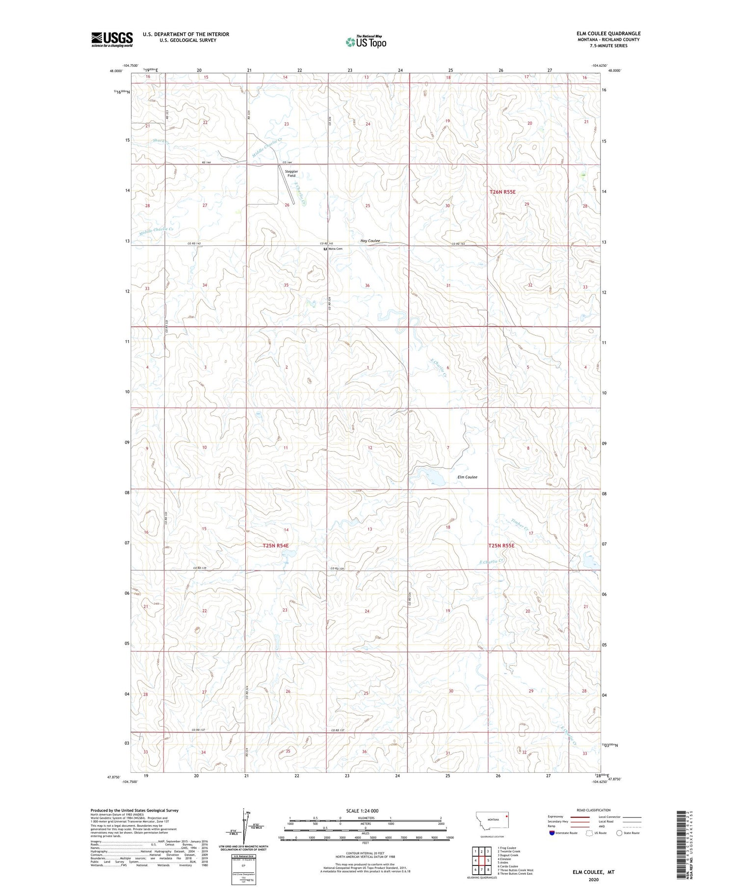
2020 topographic map quadrangle Elm Coulee in the state of Montana. Scale: 1:24000. Based on the newly updated USGS 7.5' US Topo map series, this map is in the following counties: Richland. The map contains contour data, water features, and other items you are used to seeing on USGS maps, but also has updated roads and other features. This is the next generation of topographic maps. Printed on high-quality waterproof paper with UV fade-resistant inks.
Quads adjacent to this one:
West: Elmdale
Northwest: Frog Coulee
North: Twomile Creek
Northeast: Dugout Creek
East: Andes
Southeast: Three Buttes Creek East
South: Three Buttes Creek West
Southwest: Carda Coulee
Contains the following named places: 25N54E12AABC01 Well, 25N54E22AACD01 Well, 26N54E21AAAA01 Well, 26N55E19B___01 Well, 26N55E29DAAA01 Well, Bidegary Dam, Elm Coulee, Elm Dam, Hay Coulee, Middle Charlie Creek, Mona, Mona Cemetery, Mona Church of Christ, Mona Post Office, Peer Number 1 Dam, Shack Creek, Spring Lake Post Office, Steppler Field, Timber Creek


