MyTopo
Enid SE Montana US Topo Map
Couldn't load pickup availability
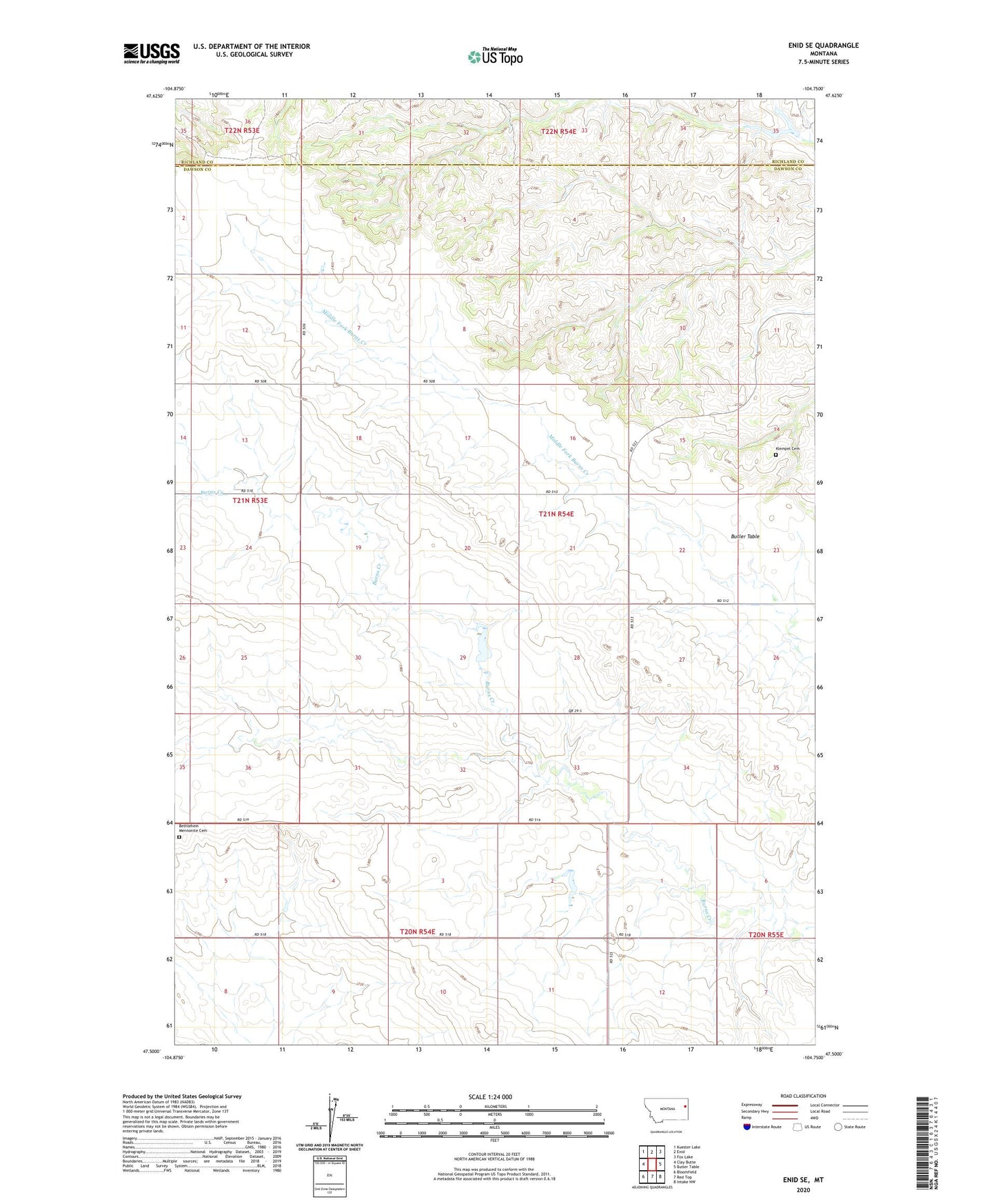
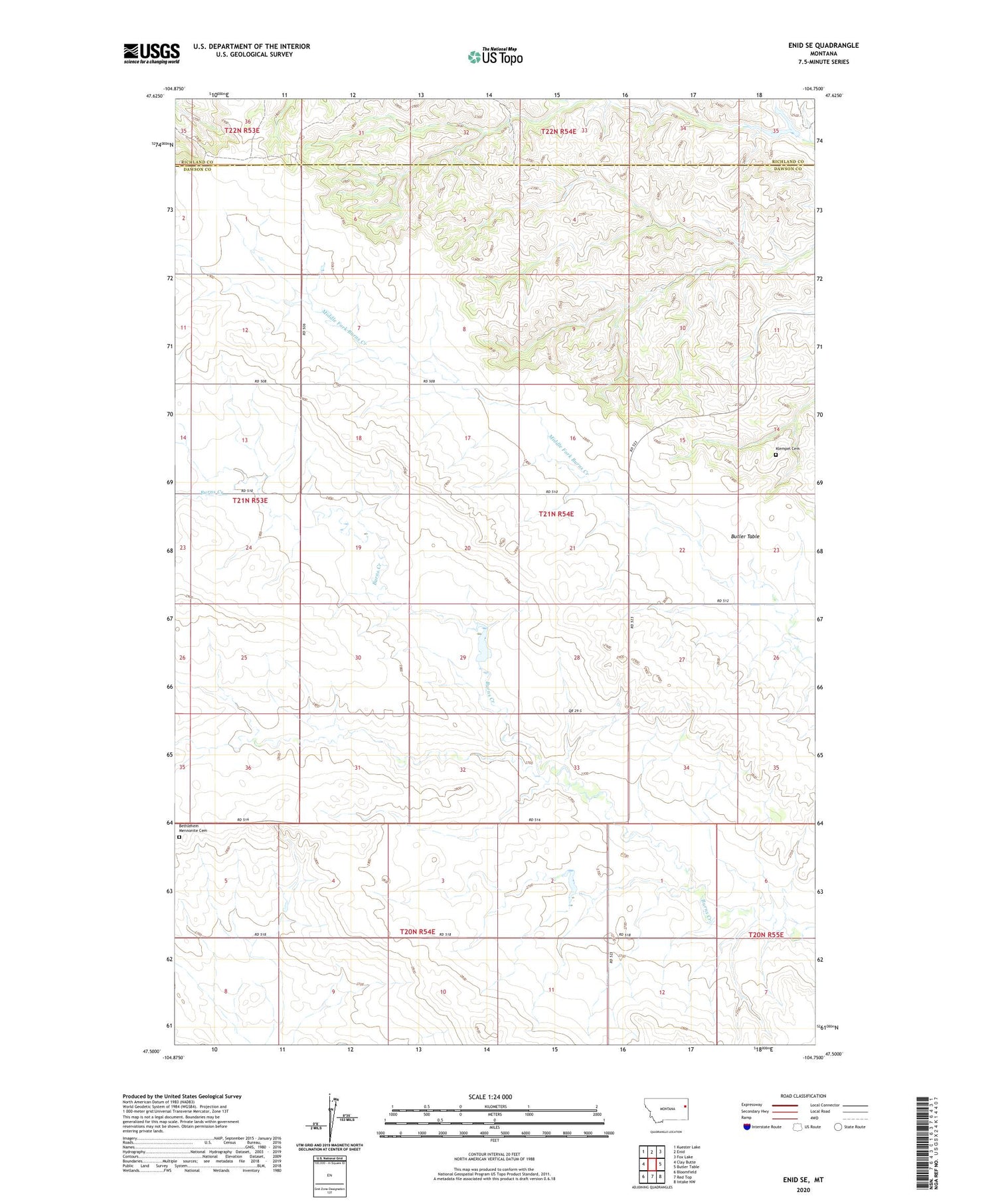
2020 topographic map quadrangle Enid SE in the state of Montana. Scale: 1:24000. Based on the newly updated USGS 7.5' US Topo map series, this map is in the following counties: Dawson, Richland. The map contains contour data, water features, and other items you are used to seeing on USGS maps, but also has updated roads and other features. This is the next generation of topographic maps. Printed on high-quality waterproof paper with UV fade-resistant inks.
Quads adjacent to this one:
West: Clay Butte
Northwest: Kuester Lake
North: Enid
Northeast: Fox Lake
East: Butler Table
Southeast: Intake NW
South: Red Top
Southwest: Bloomfield
Contains the following named places: 20N54E01CBBB01 Well, 20N54E01DCDD01 Well, 20N54E02BCAA01 Well, 20N55E06BBBB01 Well, 20N55E06CDCC01 Well, 21N53E01DCCB01 Well, 21N54E04BCCB01 Well, 21N54E08CDDD01 Well, 21N54E14CACB01 Well, 21N54E22CBDD01 Well, 21N54E32ABBB01 Well, 21N54E33DCAC01 Well, Bethlehem Mennonite Cemetery, Eastern Montana Bible Camp, Farview School, Fatzinger Dam, Independent School, Klempel Cemetery, Retah Post Office, Senner Reservoir, Senner Reservoir Dam, South Valley Church, South Valley School, Strapp School, Wishbone Dam