MyTopo
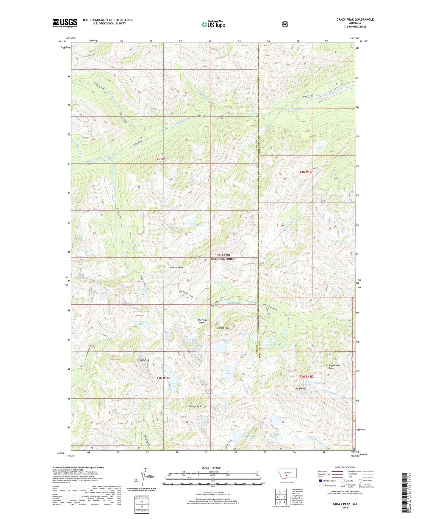
Crazy Peak Montana US Topo Map
Couldn't load pickup availability
Also explore the Crazy Peak Forest Service Topo of this same quad for updated USFS data
2024 topographic map quadrangle Crazy Peak in the state of Montana. Scale: 1:24000. Based on the newly updated USGS 7.5' US Topo map series, this map is in the following counties: Park, Sweet Grass. The map contains contour data, water features, and other items you are used to seeing on USGS maps, but also has updated roads and other features. This is the next generation of topographic maps. Printed on high-quality waterproof paper with UV fade-resistant inks.
Quads adjacent to this one:
West: Campfire Lake
Northwest: Virginia Peak
North: Loco Mountain
Northeast: Rein Lake
East: Amelong Creek
Southeast: Raspberry Butte
South: Fairview Peak
Southwest: Ibex Mountain
This map covers the same area as the classic USGS quad with code o46110a3.
Contains the following named places: Big Timber Peak, Blue Lake, Cascade Lake, Cave Lake, Comanche Creek, Conical Peak, Cottonwood Lake, Coyote Creek, Crazy Lake, Crazy Mountains, Crazy Peak, Dead Horse Creek, Diamond Lake, Druckmiller Lake, Eagle Creek, Eagle Park, Glacier Lake, Granite Lake, Granite Mountain Mine, Granite Mountain Shaft, Granite Peak, Grasshopper Glacier, Hidden Lake, Iddings Peak, Lone Lake, Lost Lake, Middle Fork Sweet Grass Creek, Milly Creek, North Fork Sweet Grass Creek, Oasis Lakes, Pear Lake, Rock Lake, Smeller Lake, South Fork Sweet Grass Creek, Stemwinder Mine, Thunder Lake, Thunder Rapids, Twin Lakes, Upper Stemwinder Mine, Wilsall Peak