MyTopo
Fife Montana US Topo Map
Couldn't load pickup availability
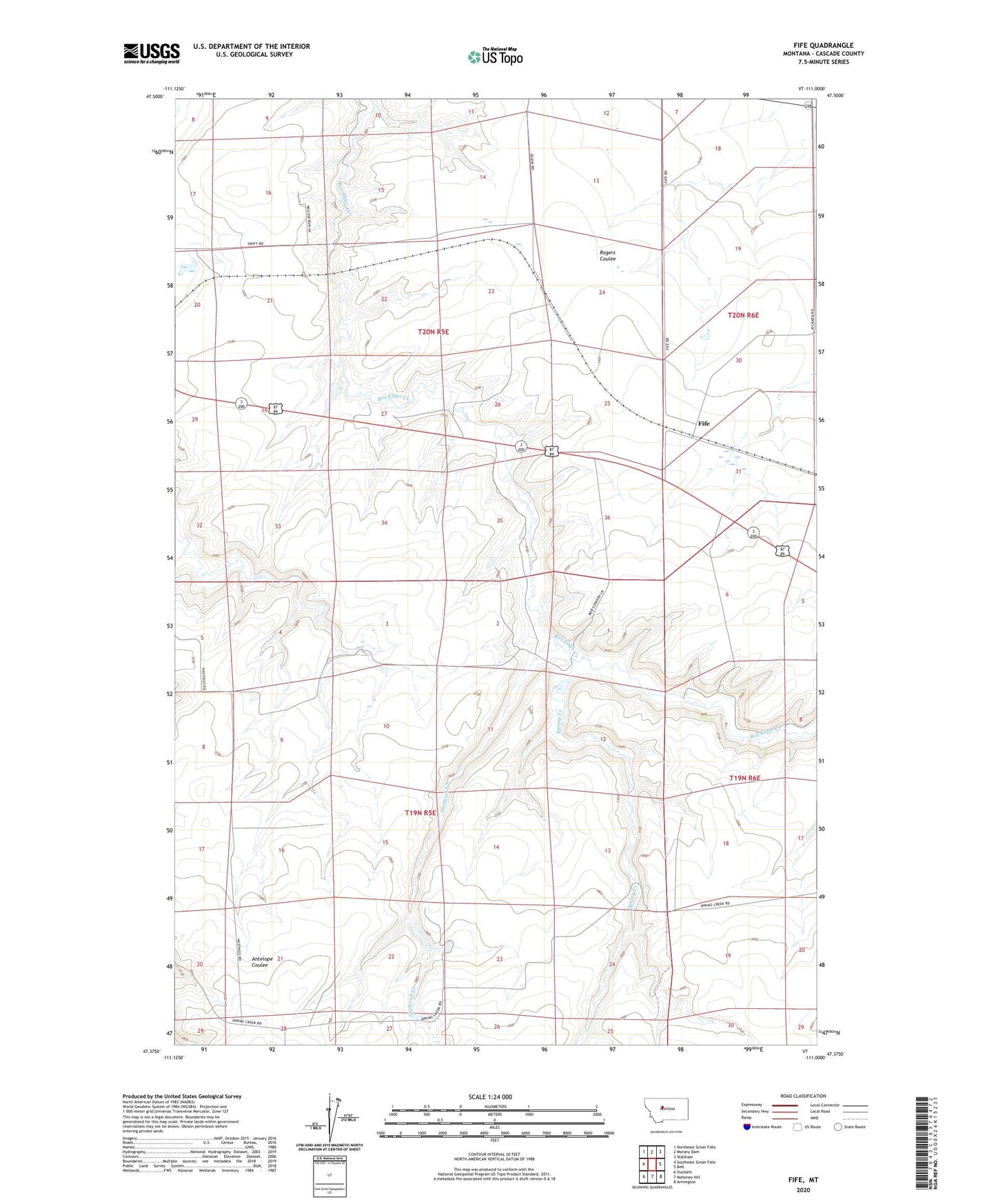
2024 topographic map quadrangle Fife in the state of Montana. Scale: 1:24000. Based on the newly updated USGS 7.5' US Topo map series, this map is in the following counties: Cascade. The map contains contour data, water features, and other items you are used to seeing on USGS maps, but also has updated roads and other features. This is the next generation of topographic maps. Printed on high-quality waterproof paper with UV fade-resistant inks.
Quads adjacent to this one:
West: Southeast Great Falls
Northwest: Northeast Great Falls
North: Morony Dam
Northeast: Waltham
East: Belt
Southeast: Armington
South: Mahoney Hill
Southwest: Stockett
This map covers the same area as the classic USGS quad with code o47111d1.
Contains the following named places: 19N05E09A___01 Well, 19N05E12A___01 Well, 19N05E23____01 Well, 19N05E23____02 Well, 19N06E06B___01 Well, 20N05E16DAAA01 Well, 20N05E32____01 Well, 20N05E32D___01 Well, 20N06E29B___01 Well, 20N06E31A___01 Well, 20N06E31BCCC01 Well, 20N06E32B___01 Well, Antelope Coulee School, Boveys Elevator Spur, Box Elder, Box Elder School, Elder Elmer Dam, Fife, Fife Post Office, Midway School, Sand Dollars Dam, Shellrock Creek, Spring Creek, Spring Creek School, Swift