MyTopo
Horsethief Coulee East Montana US Topo Map
Couldn't load pickup availability
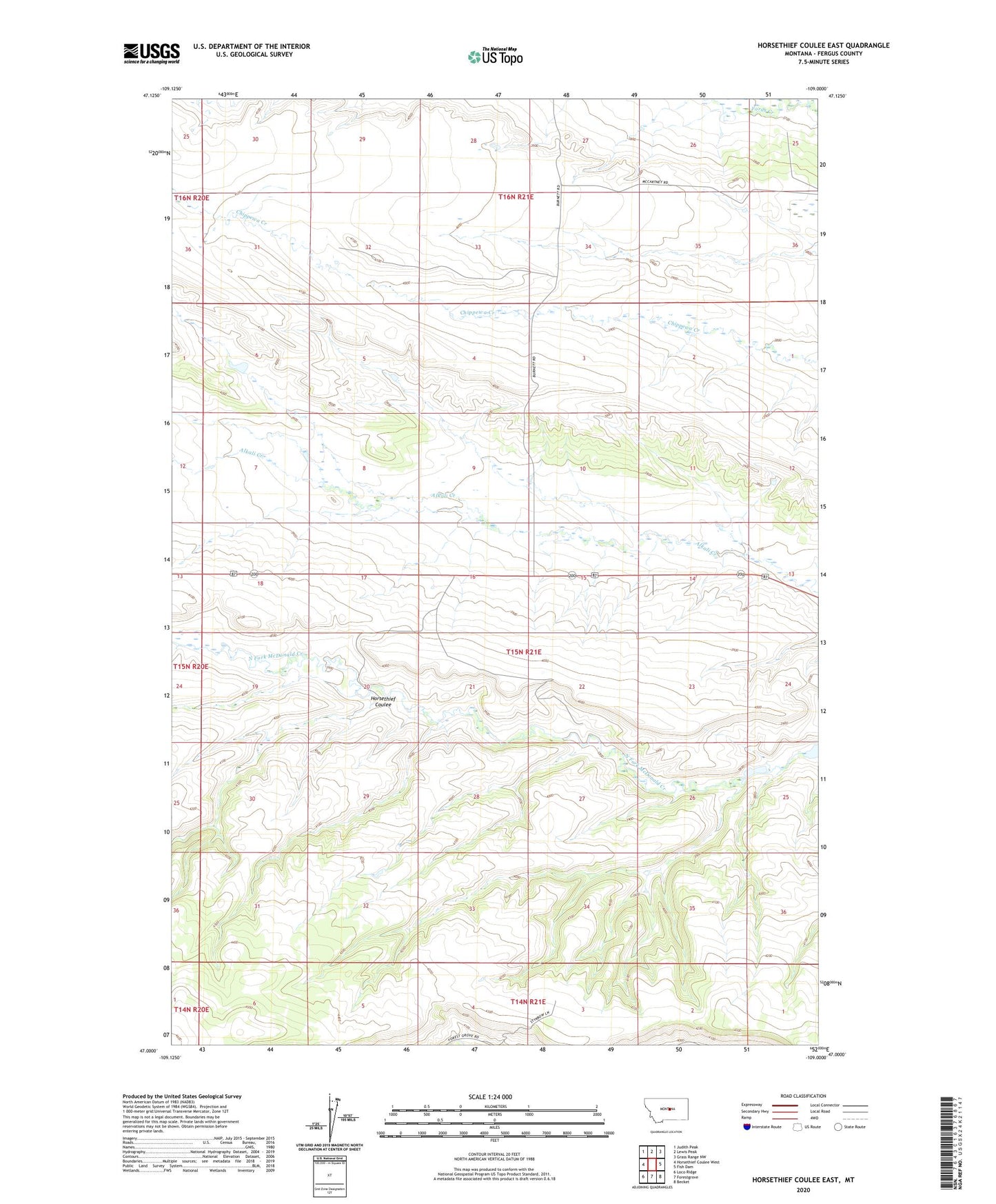
2024 topographic map quadrangle Horsethief Coulee East in the state of Montana. Scale: 1:24000. Based on the newly updated USGS 7.5' US Topo map series, this map is in the following counties: Fergus. The map contains contour data, water features, and other items you are used to seeing on USGS maps, but also has updated roads and other features. This is the next generation of topographic maps. Printed on high-quality waterproof paper with UV fade-resistant inks.
Quads adjacent to this one:
West: Horsethief Coulee West
Northwest: Judith Peak
North: Lewis Peak
Northeast: Grass Range NW
East: Fish Dam
Southeast: Becket
South: Forestgrove
Southwest: Loco Ridge
This map covers the same area as the classic USGS quad with code o47109a1.
Contains the following named places: 15N18E23ABAA01 Well, 15N21E15BCC_01 Well, 15N21E21BCAC01 Well, 16N21E31ADC_01 Well, Ayers Colony Number 1 Dam, Fort Maginnis Historical Marker, Holland Ranch Airport, Horsethief Coulee, Novary, Novary Post Office, Pleasant Plains School