MyTopo
Horsethief Coulee West Montana US Topo Map
Couldn't load pickup availability
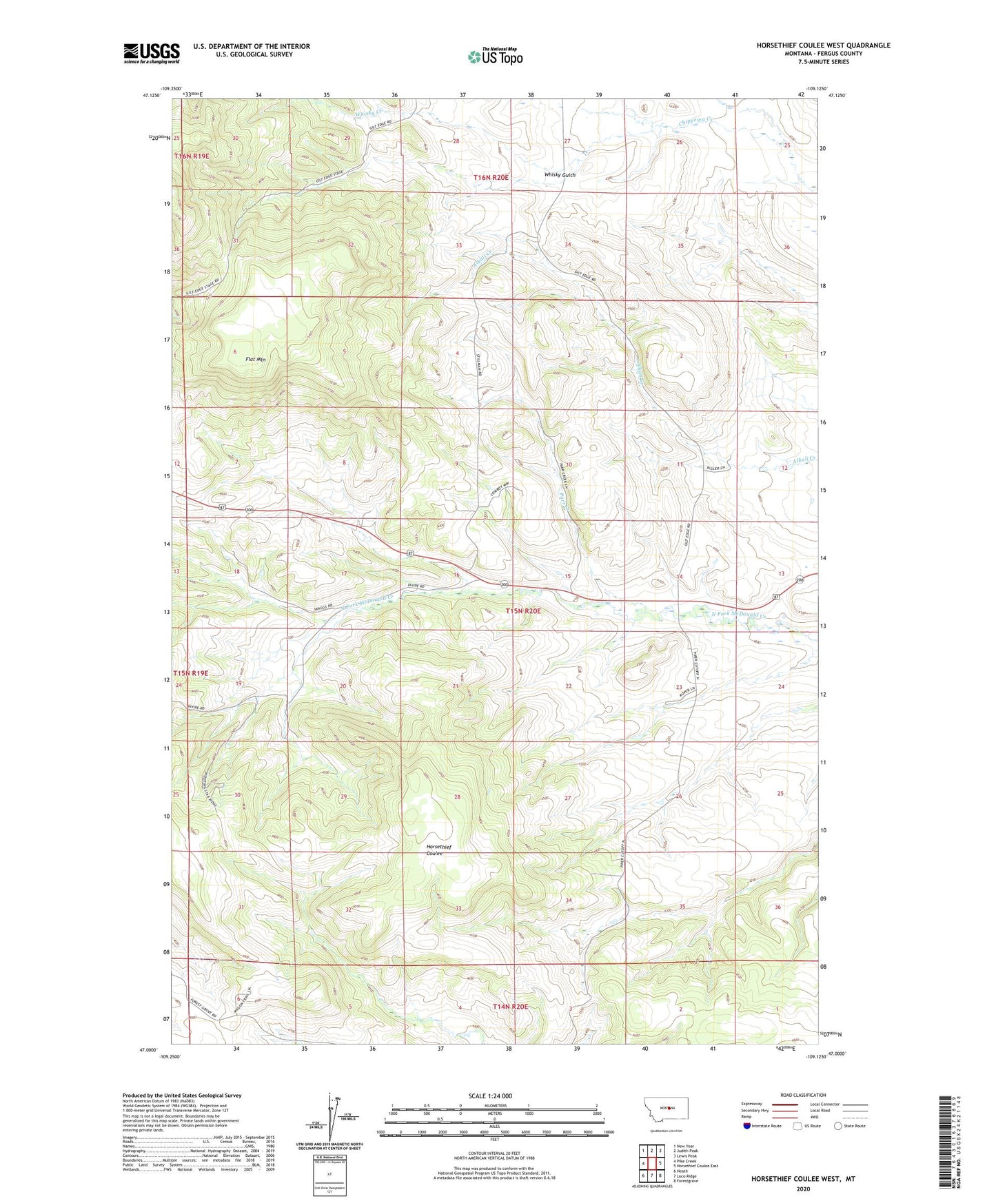
2024 topographic map quadrangle Horsethief Coulee West in the state of Montana. Scale: 1:24000. Based on the newly updated USGS 7.5' US Topo map series, this map is in the following counties: Fergus. The map contains contour data, water features, and other items you are used to seeing on USGS maps, but also has updated roads and other features. This is the next generation of topographic maps. Printed on high-quality waterproof paper with UV fade-resistant inks.
Quads adjacent to this one:
West: Pike Creek
Northwest: New Year
North: Judith Peak
Northeast: Lewis Peak
East: Horsethief Coulee East
Southeast: Forestgrove
South: Loco Ridge
Southwest: Heath
This map covers the same area as the classic USGS quad with code o47109a2.
Contains the following named places: 15N19E12DA__01 Well, 15N20E03CCCB01 Well, 15N20E09ABDA01 Well, 15N20E09ADCB01 Well, 15N20E14CAAA01 Well, Big Six Mine, Cheadle, Cheadle Post Office, Cheadle School, Flat Mountain, Nelson, Parr Creek, Skaggs, Skaggs School, Whiskey Gulch Mine, Whisky Creek, Whisky Gulch, Whisky Gulch Mine