
MyTopo
Fortine Montana US Topo Map
Couldn't load pickup availability
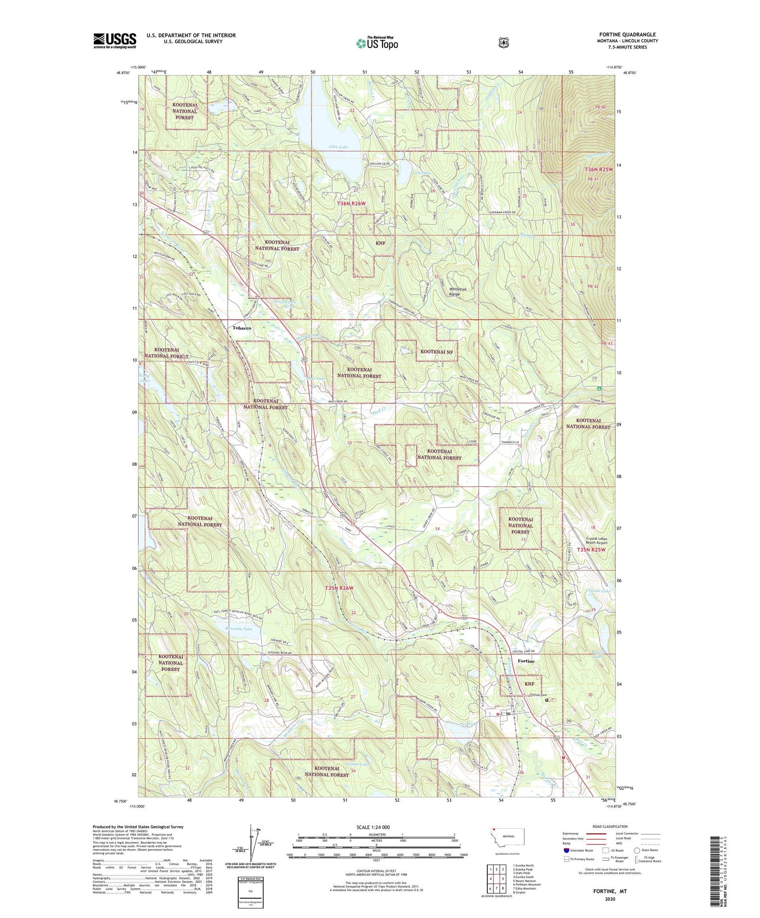
2020 topographic map quadrangle Fortine in the state of Montana. Scale: 1:24000. Based on the newly updated USGS 7.5' US Topo map series, this map is in the following counties: Lincoln. The map contains contour data, water features, and other items you are used to seeing on USGS maps, but also has updated roads and other features. This is the next generation of topographic maps. Printed on high-quality waterproof paper with UV fade-resistant inks.
Quads adjacent to this one:
West: Eureka South
Northwest: Eureka North
North: Ksanka Peak
Northeast: Stahl Peak
East: Mount Marston
Southeast: Stryker
South: Edna Mountain
Southwest: Pinkham Mountain
Contains the following named places: 35N25W19BA__01 Well, 35N25W31CA__01 Well, 35N26W08ABAA01 Well, 35N26W08ADAC01 Well, 35N26W12ACBB01 Well, 35N26W14BD__01 Well, 35N26W14BDDC01 Well, 35N26W14CABD01 Well, 35N26W25AB__01 Well, 35N26W25CA__01 Well, 35N26W27CCAB01 Well, 35N26W27CCAD01 Well, 36N26W22CBAA01 Well, 36N26W22DBBC01 Well, Barnaby Lake, Barton Creek, Bass Lake, Black Lake, Black Lake Dam, Crystal Lake, Crystal Lake Dam, Crystal Lake Resort, Crystal Lakes Golf Course, Crystal Lakes Resort Airport, Dahlberg, Deep Creek, Dry Lake, Eagle Lake Ranch, Fortine, Fortine Cemetery, Fortine Census Designated Place, Fortine Community Church, Fortine Creek, Fortine Elementary School, Fortine Post Office, Glen Creek, Glen Lake, Glen Lake Dam, Glen Lake Fishing Access Site, Grave Creek, Griffith Creek, Gussenhoven Spur, Homes Lake, Lick Creek, Lick Lake, Long Lake, Marl Lake Creek, Marston Post Office, Meadow Creek, Meadow Creek Golf Course, Mud Creek, Murphy Creek, Roe, Sherman Creek, Therriault Creek, Tobacco, Trego - Fortine - Stryker Volunteer Fire Department Station 1, Trego - Fortine - Stryker Volunteer Fire Department Station 3


